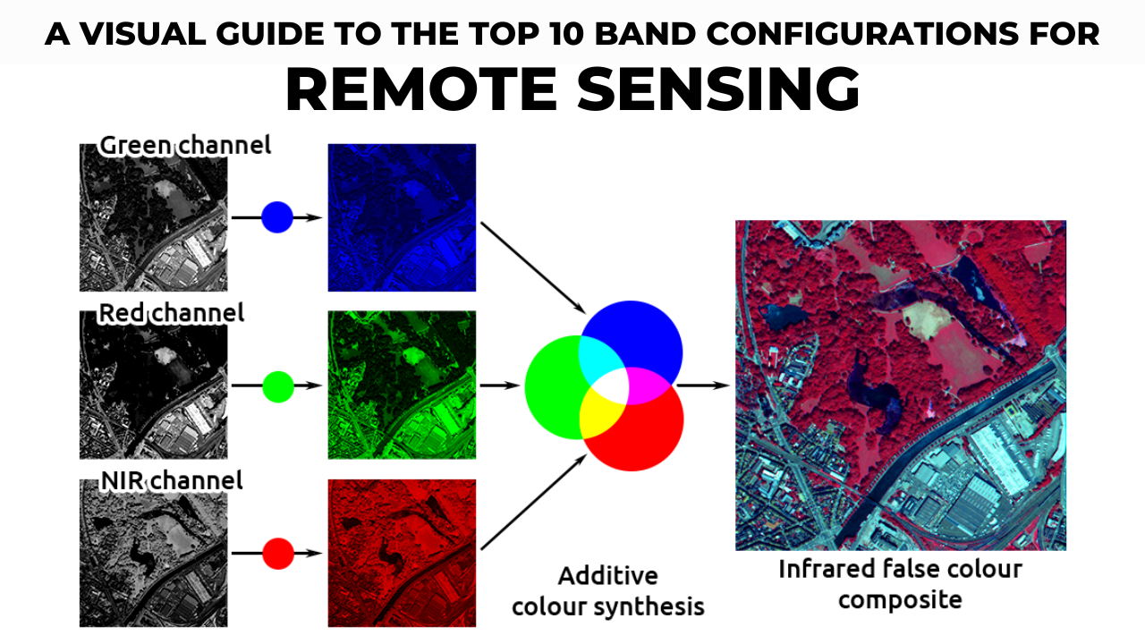
Autodesk Autocad 2025 Non-commercial, Free trial & download available, for Students

Download AutoCAD 2025 Student for Free

Overview of Autodesk AutoCAD 2025 Autodesk AutoCAD 2025 is a top-notch 3D CAD program used in architecture, engineering, and construction. It helps users plan, design, …

Read more

what is geocoding in gis

ArcGIS Geocoding Tutorial

Learn how to create and use address locators in ArcGIS with our step-by-step geocoding tutorial. Perfect for beginners looking to convert textual locations into geographic features efficiently.

arcgis drone2map download

ArcGIS Drone2Map

What Is ArcGIS Drone2Map? ArcGIS Drone2Map is an app for your computer that helps you create maps with drone images. You can use any modern …

Read more

Blockchain and Land Registry

Combining GIS (Geographic Information Systems) with blockchain technology can create powerful solutions for managing and sharing spatial data. Here are some key points about this …

Read more