Skip to content
Remote Sensing & GIS Club

Remote Sensing & GIS Club

  • Software
  • GIS Blogs
  • Quiz
  • Jobs
  • Portfolio
  • Tools
    • Shapefile Viewer
    • Calculating UTM Zone and SRID from UTM coordinates

Tools

How to find UTM Zone

Calculating UTM Zone and SRID from UTM coordinates

February 2, 2025February 2, 2025

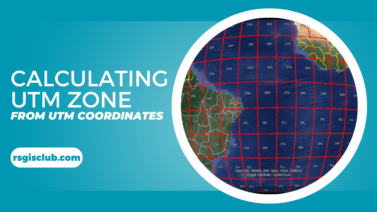
Introduction In 2021, a construction crew in Colorado accidentally bulldozed the wrong plot of land—a $200,000 mistake traced to a decimal place error in geographic …

Read more

  • Featured
  • Fiverr
  • GIS Blogs
  • Jobs
  • Maps
  • Reviews
  • Software
  • Tools
  • Uncategorized

Tags

advance GIS application if gis in agriculture arcgis arc gis Arcgis online arcgisonline arcgis pro arcmap cartography data analysis Data Visualization esri esri company geographic information geographic information system geo information system geo maps Geospatial geospatial analysis Geospatial Data geospatial information systems Geospatial Technology gis gis analysis gis jobs GIS Mapping GIS professionals gis software map mapping my esri perfect gis python qgis remote sensing remote sensing data reviews satellite imagery soledad sony alpha spatial Spatial Analysis Spatial Data tech visualization
© RSGIS Club. All Rights Reserved.