
The best GIS software applications help you turn simple location data into clear answers. A geographic information system lets you collect spatial data, stack it in layers on a map, and see patterns you would miss in a spreadsheet. City planners use it to design roads. Farmers use it to check their fields. Researchers use it to track floods, forests, and climate change.
The hard part is choosing. Some GIS programs cost thousands of dollars a year. Others are free and open source, yet strong enough for serious spatial analysis. Pick the wrong one and you may lose weeks to file-format problems, surprise license fees, or a learning curve you never needed.
That is why we built this GIS software list. It covers the top GIS software for digital mapping, from enterprise platforms to the best free GIS software. For every tool, you will see what it does well, where it falls short, what it costs, and who it suits best. Want a quick overview first? Jump to the GIS software comparison table. Let’s find the right fit for you.
Last updated: [Month Year]. Prices, features, and platform support change often, so always confirm details on each vendor’s website.
Quick Navigation
- GIS Software Comparison Table
- Best Desktop GIS Software
- Best Free and Open Source GIS Software
- Best Remote Sensing and Image Processing Software
- Best Cloud-Based and Web GIS Platforms
- Best Drone Mapping, LiDAR, and Photogrammetry Software
- Best Developer and Spatial Database Tools
- Best GIS Software by Use Case
- Free vs. Paid GIS Software
- How to Choose the Right GIS Software
- FAQs
Best GIS Software Comparison Table
Use this table to compare all 30 tools at a glance, then click a tool name to jump to its full review. Prices checked [Month Year].
| # | Tool | Type | Best For | Pricing | Platform | Skill Level |
|---|---|---|---|---|---|---|
| 1 | ArcGIS Pro | Desktop GIS | Enterprise mapping and analysis | Paid (subscription) | Windows | Intermediate |
| 2 | Global Mapper | Desktop GIS | LiDAR, terrain, value | Paid (license) | Windows (check Mac) | Beginner-Intermediate |
| 3 | MapInfo Pro | Desktop GIS | Business and location intelligence | Paid (license) | Windows | Intermediate |
| 4 | Manifold | Desktop GIS | Fast analysis of big data | Paid (low cost) | Windows | Advanced |
| 5 | QGIS | Free/open source | General GIS, all levels | Free | Windows, Mac, Linux | Beginner-Intermediate |
| 6 | GRASS GIS | Free/open source | Raster and geoprocessing | Free | Windows, Mac, Linux | Advanced |
| 7 | gvSIG | Free/open source | Public-sector desktop GIS | Free | Windows, Mac, Linux | Intermediate |
| 8 | SAGA GIS | Free/open source | Terrain, hydrology, geostatistics | Free | Windows, Linux, Mac | Intermediate |
| 9 | ILWIS | Free/open source | Education and remote sensing basics | Free | Windows | Beginner-Intermediate |
| 10 | ENVI | Remote sensing | Hyperspectral and multispectral | Paid (license) | Windows, Linux | Intermediate-Advanced |
| 11 | ERDAS IMAGINE | Remote sensing | Large imagery projects | Paid (license) | Windows | Intermediate-Advanced |
| 12 | PCI Geomatica | Remote sensing | Orthorectification, SAR, automation | Paid (license) | Windows, Linux | Advanced |
| 13 | SNAP (ESA) | Remote sensing | Sentinel and SAR data | Free | Windows, Mac, Linux | Intermediate |
| 14 | Orfeo ToolBox | Remote sensing | High-volume image processing | Free | Windows, Mac, Linux | Advanced |
| 15 | eCognition | Remote sensing | Object-based image analysis | Paid (license) | Windows | Advanced |
| 16 | TerrSet (IDRISI) | Remote sensing | Land change modeling | Paid (license) | Windows | Intermediate |
| 17 | Semi-Automatic Classification Plugin | Remote sensing | Land cover classification in QGIS | Free | Via QGIS | Beginner-Intermediate |
| 18 | Google Earth Engine | Cloud | Planetary-scale analysis | Free (non-commercial); paid commercial | Web | Intermediate (coding) |
| 19 | Sentinel Hub / EO Browser | Cloud | Quick imagery viewing | Free viewer; paid API | Web | Beginner |
| 20 | Microsoft Planetary Computer | Cloud | Open data and APIs | Free data access | Web/API | Advanced (coding) |
| 21 | Google Earth Pro | Cloud/visualization | Historical imagery, simple mapping | Free | Windows, Mac, Linux | Beginner |
| 22 | ArcGIS Online | Cloud | Web maps and team sharing | Paid (subscription) | Web | Beginner-Intermediate |
| 23 | Pix4D | Drone/photogrammetry | Drone mapping and 3D models | Paid (subscription) | Windows, Mac | Beginner-Intermediate |
| 24 | Agisoft Metashape | Drone/photogrammetry | Photogrammetry, point clouds | Paid (license) | Windows, Mac, Linux | Intermediate |
| 25 | OpenDroneMap | Drone/photogrammetry | Free drone image processing | Free | Windows, Mac, Linux | Intermediate |
| 26 | CloudCompare | LiDAR/point cloud | Point cloud analysis | Free | Windows, Mac, Linux | Intermediate |
| 27 | Python stack (GDAL, Rasterio, GeoPandas) | Developer | Automation, custom workflows | Free | Cross-platform | Advanced |
| 28 | R (terra, sf) | Developer | Statistical and spatial analysis | Free | Cross-platform | Advanced |
| 29 | PostGIS + GeoServer | Developer/server | Spatial databases, web publishing | Free | Cross-platform | Advanced |
| 30 | WhiteboxTools | Developer | Terrain and hydrology | Free | Cross-platform | Intermediate |
Best Desktop GIS Software
Desktop GIS software is where most professional mapping happens. These GIS programs run on your computer, manage large geodatabases, and offer the deepest analysis tools. The four tools below are paid, and each is one of the best GIS tools for a different type of user. If you are comparing GIS software pricing, this group gives you a good range, from enterprise to budget-friendly.
1. ArcGIS Pro: The Industry Standard for Professional GIS Software

ArcGIS Pro is made by Esri, one of the biggest names in mapping. Governments, utilities, and large organizations rely on it every day. If a job posting asks for GIS experience, there is a good chance it means ArcGIS. It is also the successor to ArcMap, so anyone planning a move should read our guide to ArcGIS Desktop end of life.
The software uses a ribbon-style layout, similar to Microsoft Office, so tools are grouped and easy to find once you learn the basics. A big strength is that 2D and 3D maps live in the same project. You can design a flat map, then switch to a 3D view of the same area without leaving the program.
It also handles the technical side well. It manages geodatabases, map projections, and coordinate reference systems with ease, and it connects directly to ArcGIS Online, so sharing maps with your team is simple. For automation, Python integration through ArcPy and ModelBuilder lets you run repeat geoprocessing tasks in a few clicks. It is not free, but many professionals feel the depth of tools is worth the cost.
What Makes ArcGIS Pro Stand Out
- Hundreds of built-in geoprocessing and analysis tools
- 2D and 3D mapping in one project
- Python integration and ModelBuilder for scripting and automation
- Easy sharing through ArcGIS Online
- Strong support, training, and a huge user community
Things to Consider
ArcGIS Pro can feel overwhelming for beginners, and the learning curve is real. The subscription cost adds up for small teams, and it only runs on Windows. Large projects also have demanding system requirements, so check your computer before you commit. A free trial is usually available, so test it first.
- Best For: Government agencies, utilities, city planners, and large organizations
- Platform: Windows
- Pricing: Paid subscription
If you need the widest range of tools and dependable support, ArcGIS Pro is hard to beat. It may be more than a beginner needs, but for large-scale spatial analysis it remains the safe choice.
2. Global Mapper: Best-Value GIS Software for Terrain and LiDAR

Global Mapper is a favorite among people who work with elevation and terrain. If your projects involve hills, slopes, contours, or LiDAR point clouds, this tool handles them well. It is also one of the friendlier paid options for beginners, which makes it a popular ArcGIS alternative for surveyors and engineers.
Its biggest advantage is format support. It opens hundreds of vector and raster file types, so you rarely see a “file not supported” message. You can load a shapefile, a GeoTIFF, and a DEM (digital elevation model; see our explainer on TIN vs DEM) into the same project and start working right away.
With the optional LiDAR module, you can classify point clouds, build terrain models, and measure volumes. These features make it a strong pick for terrain analysis, construction planning, and mining. Compared to enterprise platforms, it also offers good value for the money.
What Makes Global Mapper Stand Out
- Supports a very wide range of file formats
- Built-in terrain analysis, contour, and viewshed tools
- Optional LiDAR module for point cloud work
- Clean interface that is quick to learn
- More affordable than most enterprise GIS software
Things to Consider
Global Mapper is not the strongest choice for detailed cartography or advanced database work. Its analysis depth is lighter than ArcGIS Pro, and some of its best features, like the LiDAR tools, cost extra. Operating system support can change, so check the vendor’s site before buying. A free trial is often offered.
- Best For: Surveyors, engineers, and anyone working with terrain or LiDAR
- Platform: Windows (check the vendor’s site for Mac support)
- Pricing: Paid license
Global Mapper proves that powerful GIS software does not have to be complicated. If your work centers on the shape of the land, it gives you strong tools without an enterprise-sized bill.
3. MapInfo Pro: Business-Focused GIS Software for Location Intelligence
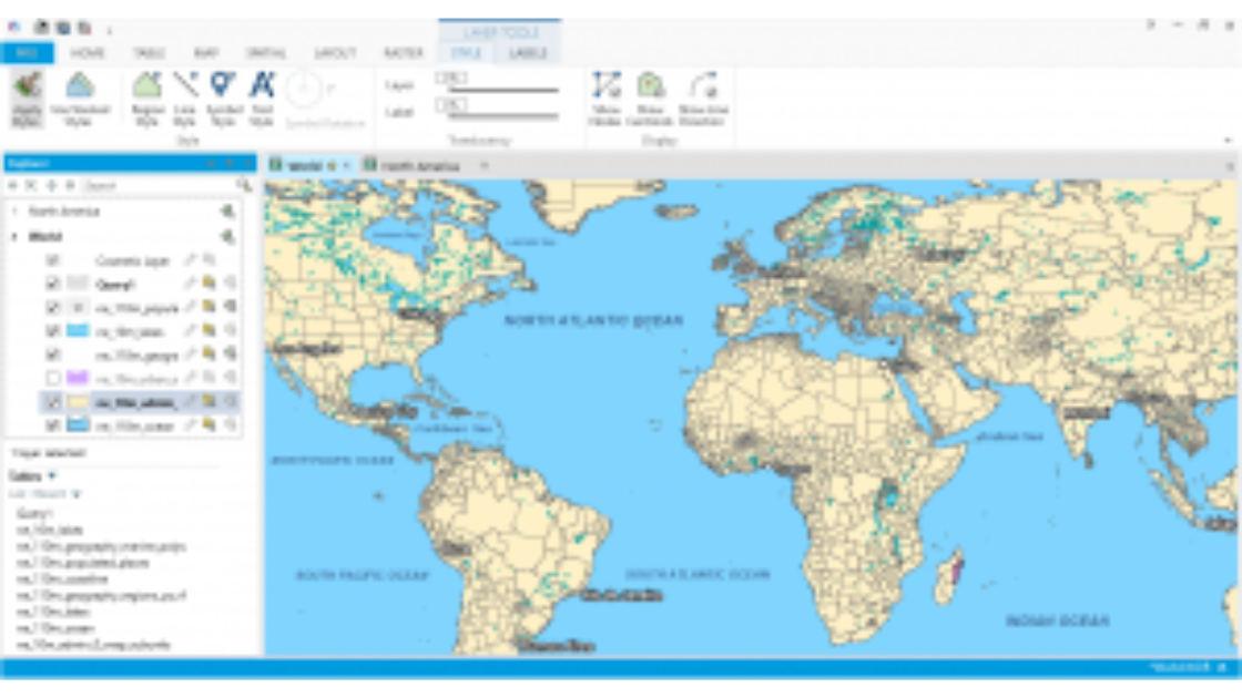
MapInfo Pro is built for people who use maps to make business decisions. Retail, banking, insurance, and telecom teams use it to answer questions like where to open a new branch or which neighborhoods have the most customers. It is a reliable map making software option for teams that care more about business results than scientific analysis.
The software works well with addresses and tables. Its geocoding tools match street addresses to points on a map, so you can turn a customer list into a visual map in minutes. From there, thematic mapping lets you color areas by sales, population, or risk, so patterns in your vector data stand out quickly.
The interface follows a ribbon layout that feels familiar to anyone who has used Office software. That makes it easier for business analysts, not just GIS specialists, to get comfortable. It is a paid product, and it fits GIS software for professionals who work with location-based business data every day.
What Makes MapInfo Pro Stand Out
- Strong address matching and geocoding tools
- Clear thematic maps for spotting business trends
- Works well with business data and tables
- Familiar, easy-to-navigate interface
- Good for territory planning and site selection
Things to Consider
MapInfo Pro is not the best pick for satellite imagery, LiDAR, or scientific analysis. Its community is smaller than QGIS or ArcGIS, so plugins and extensions are limited and fewer tutorials are available. Web sharing options are also more limited than in cloud-first tools.
- Best For: Business analysts, marketers, and location intelligence teams
- Platform: Windows
- Pricing: Paid license
If your goal is smarter business decisions rather than scientific mapping, MapInfo Pro is a strong fit. It keeps things practical and focused on real-world results.
4. Manifold: Fast, Affordable GIS Software for Large Datasets

Manifold is known for one thing above all: speed. It uses both your computer’s CPU and graphics card to process data in parallel, so big datasets load and analyze much faster than in many other GIS programs. Analysts often treat it as a fast, low-cost ArcGIS alternative.
It also includes a built-in spatial database and supports SQL for spatial queries. Raster data, vector data, and tables can live in one project, so you do not have to jump between tools. For people who like working with queries and large files, this is a real advantage, and its scripting and automation options help with repeat tasks.
Price is another plus. Manifold costs far less than most professional GIS software, and a free viewer is available for opening and reviewing projects. That makes it a smart choice for power users on a budget, though it is not a beginner-first tool.
What Makes Manifold Stand Out
- GPU-accelerated processing for very fast results
- Built-in spatial database with SQL support
- Raster, vector, and tables in a single project
- Scripting and automation for repeat work
- Low-cost license and a free viewer
Things to Consider
The interface looks dated, and the learning curve is steep for people who are not comfortable with queries or technical workflows. The user community is small, so finding tutorials or shared templates takes more effort. Map design and cartography tools are also less polished than in ArcGIS Pro or QGIS.
- Best For: Analysts and power users working with large datasets
- Platform: Windows
- Pricing: Low-cost paid license (free viewer available)
Manifold shows you can get professional performance without a professional price tag. If speed matters more than fancy map design, it deserves a close look.
Quick pick: Choose ArcGIS Pro for enterprise depth, Global Mapper for value, MapInfo Pro for business mapping, and Manifold for speed. Prefer free? Skip to Best Free and Open Source GIS Software.
Best Free and Open Source GIS Software
You don’t need a big budget to do serious mapping. Open source GIS software is free to download, free to use, and improved by communities of developers around the world. Many of these tools run as free GIS software for Windows, Mac, and Linux, and several match the power of paid programs. If you are weighing open source vs proprietary, this group shows how far free tools can take you. Want to go deeper into the open source world? See our list of open source GIS projects. The five tools below are the best free GIS software options for beginners, students, researchers, and small teams.
5. QGIS: The Best Free GIS Software for Beginners and Pros
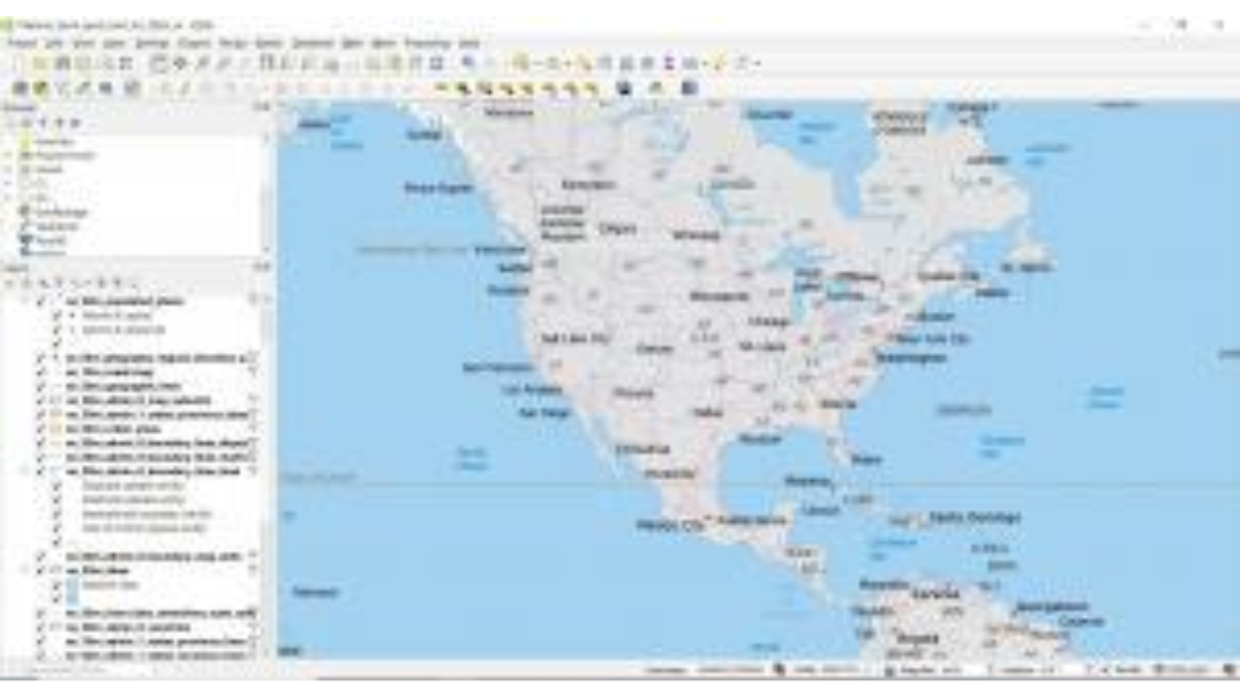
QGIS is the most popular open source GIS software in the world, and for good reason. It is free, it runs on Windows, Mac, and Linux, and it handles most everyday mapping tasks without a problem. For many people, it is the best free GIS software to start with, and a strong ArcGIS alternative for those who don’t want a subscription. Curious how it stacks up against Esri’s desktop tools? Read our comparison of QGIS vs ArcGIS (ArcMap).
You can view, edit, analyze, and style spatial data in one place. It reads shapefile, GeoTIFF, GeoJSON, and KML files, and it connects to spatial databases like PostGIS. It also includes a built-in 3D map view, so you can explore terrain and buildings from different angles without extra software.
The real magic is its plugins and extensions. Need satellite image classification, field data collection, or extra styling options? There is probably a plugin for it. QGIS also supports Python integration through PyQGIS, and its Processing toolbox brings tools from GDAL, GRASS GIS, and SAGA GIS into one window. That flexibility is why QGIS vs ArcGIS is one of the most common comparisons in the field.
What Makes QGIS Stand Out
- Completely free, with no license fees
- Works with vector data, raster data, and spatial databases
- Huge library of plugins and extensions
- Built-in 3D view and strong map styling
- Python integration for scripting and automation
- Large community, tutorials, and free learning resources
Things to Consider
QGIS is friendly at first, but advanced workflows still take time to learn. Very large datasets can slow it down on weaker computers, and the wide choice of plugins can feel confusing at the start. Support comes from the community rather than a company helpline, so expect to search forums and tutorials when you get stuck.
- Best For: Beginners, students, researchers, and teams who want a full-featured free tool
- Platform: Windows, macOS, Linux
- Pricing: Free and open source
QGIS proves that free doesn’t mean limited. If you are unsure where to begin, begin here.
6. GRASS GIS: Powerful Open Source GIS Software for Deep Analysis

GRASS GIS is one of the oldest open source GIS programs still in active use, and it remains one of the most powerful. It was built for serious geospatial analysis, especially with raster data, satellite imagery, and time series. Researchers and scientists rely on it when they need precise control over their results.
It offers hundreds of modules for tasks like terrain analysis, hydrological modeling, LiDAR processing, and image classification. It also handles 3D data and can analyze how a landscape changes over time. Advanced users can automate work through its Python API and command line, which makes scripting and automation a core strength.
The best part is that you don’t have to choose between GRASS and QGIS. Many people run GRASS tools directly inside QGIS, which gives you a friendly interface on top of a very strong analysis engine.
What Makes GRASS GIS Stand Out
- Hundreds of modules for raster, vector, and imagery analysis
- Strong tools for remote sensing and satellite image processing
- Handles LiDAR, 3D data, and time series
- Python API and command line for scripting and automation
- Works inside QGIS for an easier workflow
Things to Consider
GRASS GIS has a steep learning curve. Its interface is less modern than QGIS, and starting a project means setting up a coordinate reference system and data structure, which confuses many new users. It is also not the best choice for polished cartography, so many people use it for analysis and finish their maps elsewhere.
- Best For: Advanced users, analysts, and researchers doing heavy raster and imagery work
- Platform: Windows, macOS, Linux
- Pricing: Free and open source
If you want serious analysis power without paying a cent, GRASS GIS delivers. Just be ready to invest some learning time.
7. gvSIG: Free GIS Software Built for Public-Sector Work

gvSIG is an open source desktop GIS with strong roots in public-sector and government projects, especially across Europe and Latin America. It combines mapping, editing, and analysis in one program, and it is free for anyone to download and use.
Its editing tools feel familiar to people who have used CAD software, which makes drawing and modifying vector data straightforward. It reads common formats like shapefile and works with spatial databases, and it includes tools for 2D and 3D viewing, map layouts, and geoprocessing.
gvSIG also offers related tools for web publishing and field data collection through the wider gvSIG family. This is helpful for teams that want to build a complete workflow using free software. It may not be as widely known as QGIS, but it has a loyal user base and an active community.
What Makes gvSIG Stand Out
- Free, open source desktop GIS
- CAD-style drawing and editing tools
- 2D and 3D viewing with map layout tools
- Works with common vector data formats and spatial databases
- Related tools for web mapping and mobile data collection
Things to Consider
English documentation is more limited than for QGIS, so learning it can take longer. Its community is smaller, and the interface can feel dated. Some advanced features, like LiDAR support, are not as strong as in other free tools. Check the official site for current platform support and versions.
- Best For: Public-sector teams, educators, and users who like CAD-style editing
- Platform: Windows, macOS, Linux
- Pricing: Free and open source
gvSIG is a dependable choice if you want a free desktop GIS with editing strength and a public-sector focus. It rewards users who are willing to explore beyond the most popular tools.
8. SAGA GIS: Free GIS Software for Terrain and Geoscience Analysis
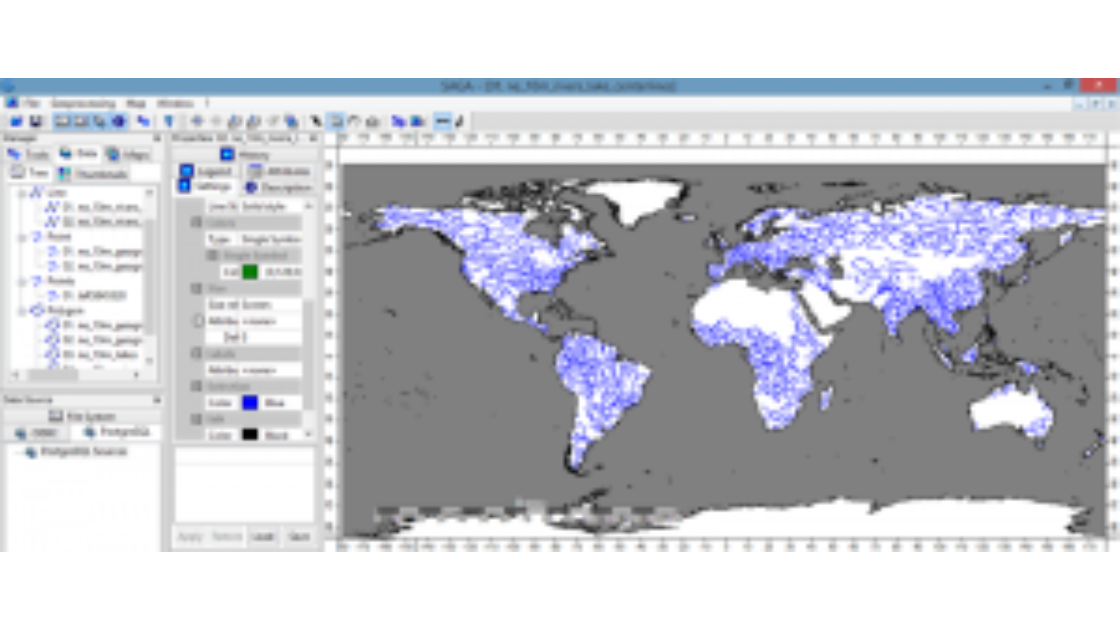
SAGA GIS stands for System for Automated Geoscientific Analyses, and that name says it all. It is a free tool built for scientists who study terrain, soil, water, and climate. If your work involves digital elevation models, SAGA is worth a serious look.
Its strength is specialized analysis. You can calculate slope, aspect, and flow paths, run hydrological modeling, and apply geostatistics methods like kriging to predict values between sample points. It works especially well with raster data, and it processes large terrain datasets quickly.
Many people use SAGA GIS together with QGIS, since its tools are available inside the QGIS Processing toolbox. It also includes a command line interface, so advanced users can run batch jobs and automate repeat tasks. It is not made for beautiful maps, but it is excellent for the science behind them.
What Makes SAGA GIS Stand Out
- Rich toolset for terrain analysis and DEM processing
- Strong hydrological modeling and geostatistics tools
- Fast processing of raster data
- Works inside QGIS for easier access
- Command line support for scripting and automation
Things to Consider
SAGA GIS can feel confusing for beginners. The interface looks older, and some tools have limited documentation, so you may need trial and error to get the settings right. It also has limited map design, layout, and web-sharing features, so most users create their final maps in another program.
- Best For: Geoscientists, environmental researchers, and terrain analysts
- Platform: Windows, Linux (also available on macOS)
- Pricing: Free and open source
SAGA GIS is a specialist tool, and it does its job very well. For terrain and geoscience work, it is one of the best free GIS options available.
9. ILWIS: Free GIS Software for Remote Sensing and Education
ILWIS stands for Integrated Land and Water Information System. It is a free, open source tool that combines GIS and image processing in one package. It was created for training and research, and it is still popular in universities and environmental programs.
What sets ILWIS apart is its focus on remote sensing. You can import satellite imagery, run image classification, and study how land cover changes over time. It handles both raster data and vector data, and its simple structure makes the basics of spatial analysis easier to teach and learn.
It is also lightweight, so it runs well on modest computers. That makes it a practical pick for classrooms and for anyone learning how GIS and satellite image processing work together, without a big software installation.
What Makes ILWIS Stand Out
- Combines GIS and image processing in one tool
- Supports image classification and land cover analysis
- Works with both raster and vector data
- Lightweight, so it runs on modest computers
- Well suited to teaching and research
Things to Consider
The interface feels dated, and it does not have the plugin ecosystem or community size of QGIS. Tutorials are limited, so new users may need patience. It also lacks advanced cartography and web mapping tools, and updates are less frequent than in more active projects.
- Best For: Students, educators, and researchers working with satellite imagery
- Platform: Windows
- Pricing: Free and open source
ILWIS may not be flashy, but it is a solid free GIS software for students and remote sensing beginners. If you want to learn the fundamentals without spending money, it does the job.
Quick pick: Start with QGIS for all-round free GIS software. Add GRASS GIS or SAGA GIS for deeper analysis, choose gvSIG for CAD-style editing, and use ILWIS to learn remote sensing basics.
Best Remote Sensing and Image Processing Software
Maps show where things are. Satellite and aerial images show what is happening on the ground. Remote sensing software helps you read those images, from spotting crop stress to tracking forest loss and city growth. The best GIS and remote sensing software can process multispectral imagery, run image classification, and measure change over time. For a shorter, focused roundup, see our guide to the 15 best remote sensing software tools. The eight tools below cover everything from advanced paid platforms to free options for satellite image processing.
10. ENVI: The Leading Remote Sensing Software for Spectral Analysis
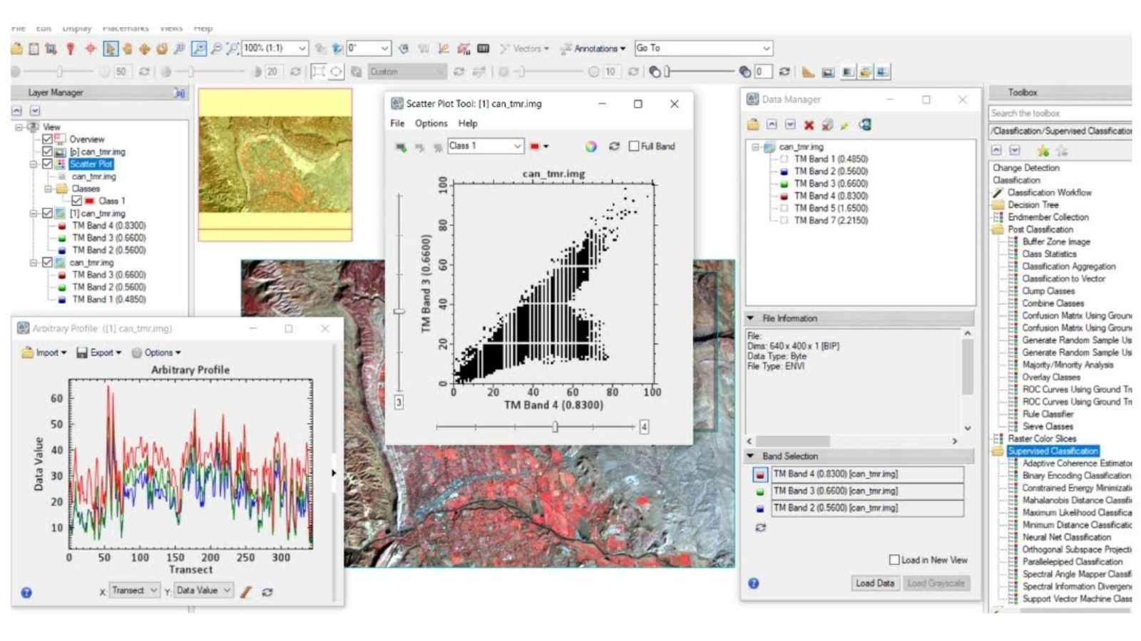
ENVI is one of the most respected names in remote sensing software. It is designed for analyzing multispectral and hyperspectral imagery, which means images that capture far more detail than a regular photo. Scientists, defense analysts, and environmental teams use it to identify materials, monitor vegetation, and detect changes on the ground.
The tool includes ready-made workflows for common tasks. You can calculate NDVI to check plant health, run land cover classification, and perform change detection between two dates. It also offers deep learning tools and supports scripting through IDL, so advanced users can build repeatable processes. Optional modules extend it to areas like radar (SAR) analysis.
ENVI also works alongside ArcGIS, so results can move between your imagery and GIS projects without much hassle. It is not cheap, but it is often the first choice when accuracy and spectral depth matter.
What Makes ENVI Stand Out
- Strong hyperspectral and multispectral imagery analysis
- One-click workflows for NDVI, classification, and change detection
- Deep learning tools for feature extraction
- Scripting and automation through IDL
- Integrates with ArcGIS
Things to Consider
ENVI is a premium product with a premium price, and some of the best features are sold as add-on modules. The learning curve is real for beginners. Check the vendor’s site for current operating system support and licensing options.
- Best For: Researchers, agriculture analysts, defense and environmental teams
- Platform: Windows, Linux
- Pricing: Paid license (modules sold separately)
If your work depends on precise spectral analysis, ENVI is one of the best software choices for remote sensing analysis.
11. ERDAS IMAGINE: Powerful Satellite Image Processing Software for Large Projects
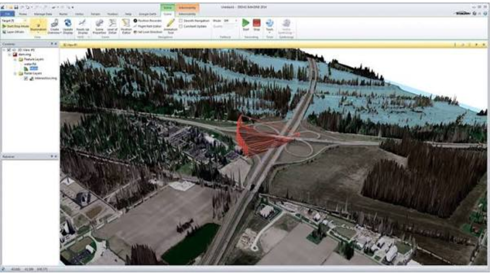
ERDAS IMAGINE is a long-standing name in image processing. It is built to handle very large raster data files, such as country-wide satellite mosaics, without slowing down. Government agencies and mapping companies often choose it for production-scale work.
It covers the full imagery workflow. You can correct images, combine them into mosaics, classify land cover, and extract features. Its Spatial Modeler lets you build visual workflows by connecting tools together, so repeated tasks become simple to run again. It also supports photogrammetry and LiDAR tools for creating elevation data.
ERDAS IMAGINE works well with other tools from the same vendor, including GeoMedia, which makes it a common pick for organizations that already use that ecosystem.
What Makes ERDAS IMAGINE Stand Out
- Handles very large imagery datasets
- Visual Spatial Modeler for building automated workflows
- Image classification, mosaicking, and feature extraction
- Photogrammetry and LiDAR support
- Works well with GeoMedia and other enterprise tools
Things to Consider
The price puts it out of reach for most individuals and small teams. It also takes time to learn, and the interface can feel heavy compared to newer tools. Check current licensing and system requirements before buying.
- Best For: Government agencies, mapping firms, and large imagery projects
- Platform: Windows
- Pricing: Paid license
If you process large volumes of imagery on a regular basis, ERDAS IMAGINE gives you dependable, production-level tools.
12. PCI Geomatica: Automation-Friendly Software for Orthorectification and SAR
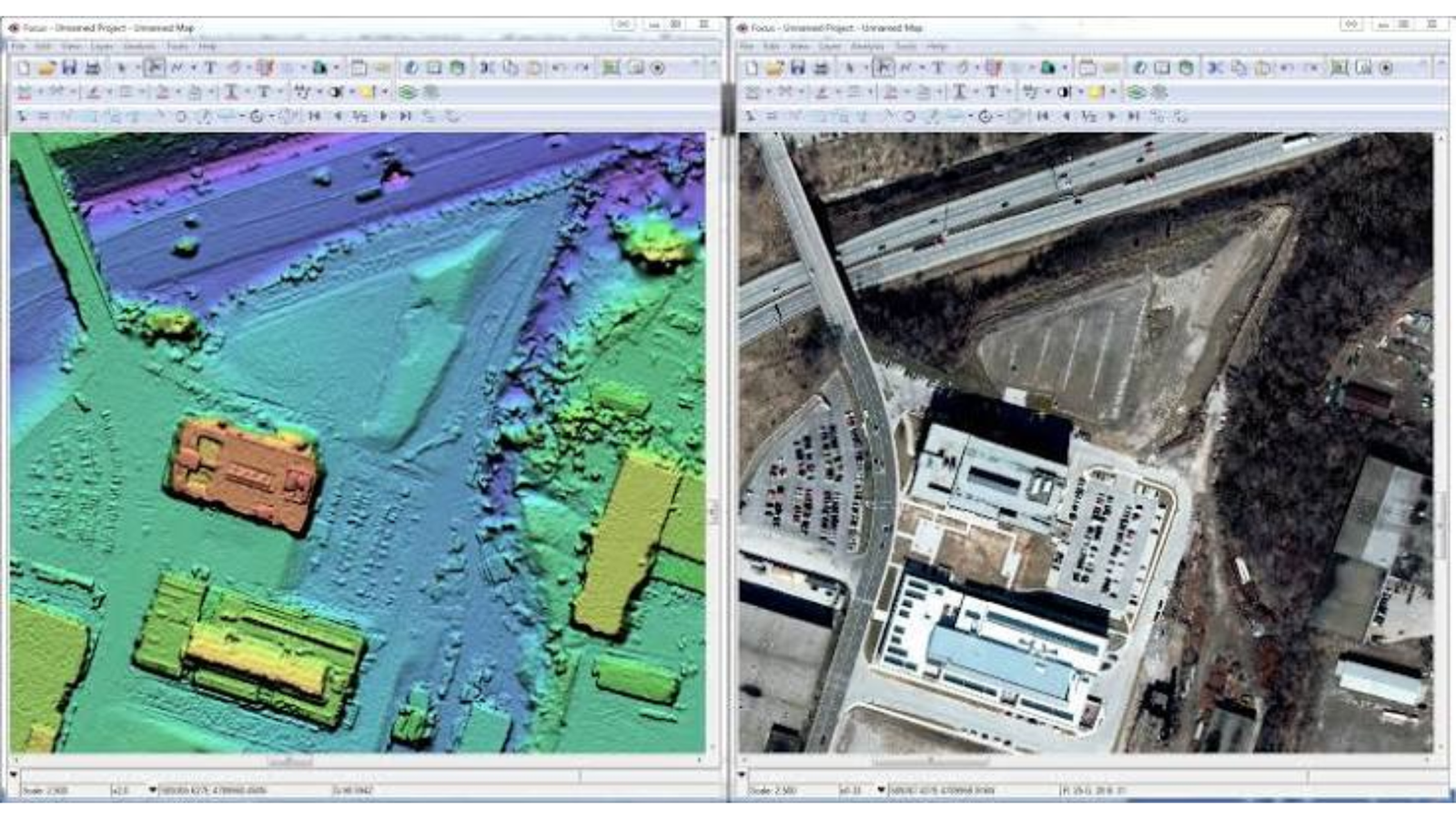
PCI Geomatica is a remote sensing and image processing platform known for accuracy and automation. It is especially strong at orthorectification, which means correcting satellite and aerial images so they line up properly with real-world coordinates.
It also supports radar (SAR) data, which is useful because radar can see through clouds and works day or night. That makes it valuable for flood mapping, ground movement studies, and monitoring in cloudy regions. Its tools for image classification, atmospheric correction, and mosaicking round out a complete workflow.
Automation is another highlight. Geomatica includes Python scripting and batch processing, so teams that handle large amounts of imagery can set up repeatable pipelines and save hours of manual work.
What Makes PCI Geomatica Stand Out
- High-accuracy orthorectification and image correction
- Strong SAR data processing
- Python scripting and batch processing
- Tools for classification, mosaicking, and atmospheric correction
- Built for high-volume imagery production
Things to Consider
It is a paid, professional product, and beginners may find it complex. Its community is smaller than open source tools, so free tutorials are harder to find. Confirm current pricing and platform support on the vendor’s site.
- Best For: Imagery producers, SAR analysts, and teams that need automation
- Platform: Windows, Linux
- Pricing: Paid license
PCI Geomatica suits teams that care about accuracy at scale and want to automate the boring parts of imagery work.
13. SNAP (ESA): Free Software for Sentinel Satellite Data and SAR
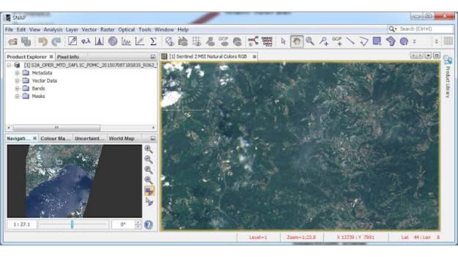
SNAP, the Sentinel Application Platform, is a free toolbox created by the European Space Agency. It is designed to work with data from the Sentinel satellites, and it is one of the best free options for satellite image processing.
SNAP includes separate toolboxes for different sensors. The Sentinel-1 toolbox handles radar imagery, while the Sentinel-2 toolbox handles optical multispectral imagery. You can calculate NDVI and other indices, correct images, and run classification. Its radar tools are especially valued for flood mapping and surface change studies.
It also lets you build graphs that chain steps together, so you can process many images the same way. Users can add scripting through Python, making SNAP a smart free choice for students and researchers who work with Sentinel data.
What Makes SNAP Stand Out
- Free and built specifically for Sentinel data
- Strong SAR processing tools
- NDVI and other spectral index calculations
- Graph builder for batch processing
- Python support for scripting and automation
Things to Consider
SNAP can be heavy on memory when working with large images, so a computer with plenty of RAM helps. The interface has a learning curve, and it is less flexible for general GIS mapping. Many users export results to QGIS for final maps.
- Best For: Students, researchers, and anyone working with Sentinel or SAR data
- Platform: Windows, macOS, Linux
- Pricing: Free
SNAP is a top pick if you want professional-grade satellite tools without paying for a license.
14. Orfeo ToolBox (OTB): Open Source Image Processing for Large Datasets
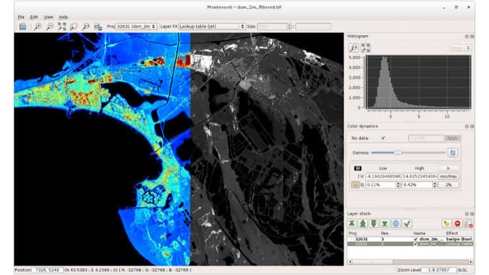
Orfeo ToolBox, often called OTB, is an open source library for processing satellite images. It was created by the French space agency CNES, and it is built to handle very large images efficiently by processing them in small pieces.
OTB includes tools for image classification, segmentation, orthorectification, pansharpening, and change detection. It works with both optical and radar imagery, and its machine learning tools are popular for land cover classification projects.
Most people use OTB alongside QGIS, where its tools appear in the Processing toolbox. Developers can also call it from Python or the command line, which makes it a great fit for automated pipelines and custom workflows.
What Makes Orfeo ToolBox Stand Out
- Free and open source
- Efficient processing of very large images
- Machine learning tools for image classification
- Works with optical and SAR imagery
- Integrates with QGIS, Python, and the command line
Things to Consider
OTB is technical. It has no polished stand-alone interface for beginners, and documentation can feel dense. Expect to spend time learning command-line tools or the QGIS integration before it feels comfortable.
- Best For: Advanced users, developers, and researchers processing large image sets
- Platform: Windows, macOS, Linux
- Pricing: Free and open source
If you want a free, powerful engine for image classification and large-scale processing, OTB is well worth learning.
15. eCognition: Object-Based Image Analysis Software
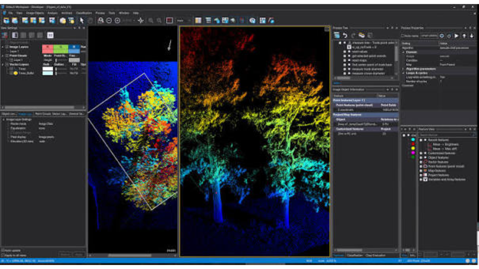
eCognition takes a different approach to image classification. Instead of looking at one pixel at a time, it groups pixels into meaningful objects, such as a building, a field, or a tree crown, and then classifies those objects. This method is called object-based image analysis (OBIA).
This approach often gives cleaner, more accurate results on high-resolution imagery. You build rule sets that describe what each feature should look like, based on color, shape, size, and context. Once created, these rule sets can be reused on new images, which saves time on repeated projects.
eCognition is used for tasks like mapping buildings, extracting roads, classifying forests, and updating land use maps. It also supports LiDAR and works with both raster and vector data.
What Makes eCognition Stand Out
- Leading object-based image analysis (OBIA) tools
- Reusable rule sets for repeatable workflows
- Strong results on high-resolution imagery
- Supports LiDAR and multiple data types
- Well suited to feature extraction and land use mapping
Things to Consider
eCognition is a specialist, paid tool with a steep learning curve. Building good rule sets takes practice and domain knowledge. It is not a general GIS package, so most users pair it with another program for map design. Check current pricing with the vendor.
- Best For: Advanced analysts and researchers doing feature extraction from high-resolution imagery
- Platform: Windows
- Pricing: Paid license
If pixel-based classification isn’t giving you clean results, eCognition’s object-based approach is worth exploring.
16. TerrSet (IDRISI): Software for Land Change and Environmental Modeling
TerrSet, formerly known as IDRISI, is an integrated system for monitoring and modeling the Earth’s surface. It comes from Clark Labs and is popular in universities and environmental organizations.
Its standout feature is land change modeling. TerrSet does not only show what changed in the past. It helps you predict what may change next, such as where deforestation or urban growth is likely to happen. It also supports habitat and biodiversity assessment, climate change studies, and earth trend analysis with time series data.
The package includes strong raster data tools, image classification, and image processing, all in a single environment. That makes it a useful teaching tool as well as a research platform.
What Makes TerrSet Stand Out
- Land change modeling and prediction tools
- Time series analysis for tracking trends
- Image classification and raster analysis
- Habitat and biodiversity assessment tools
- Widely used in academic research
Things to Consider
TerrSet is a specialist tool, so it is not the best choice for general mapping. The interface looks dated, and the community is smaller than QGIS. Cartography features are limited, so most people finish maps elsewhere.
- Best For: Environmental researchers, academics, and land change modelers
- Platform: Windows
- Pricing: Paid license
TerrSet is the right pick when your goal is to understand and predict how landscapes change over time.
17. Semi-Automatic Classification Plugin (SCP) for QGIS: Free Land Cover Classification
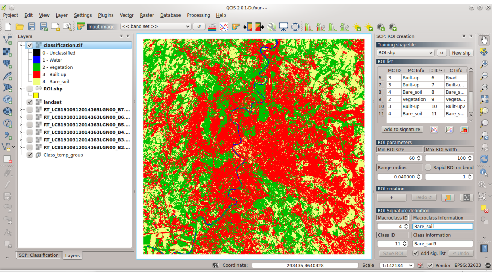
The Semi-Automatic Classification Plugin, or SCP, turns QGIS into a capable remote sensing tool. It is a free plugin that lets you download satellite images, prepare them, and run land cover classification without leaving QGIS.
The workflow is beginner-friendly. You can download Landsat and Sentinel-2 imagery, apply corrections, define training areas, and classify the image. New to the method? Read our guide to supervised vs unsupervised classification first. SCP also includes tools for accuracy assessment, change detection, and calculating spectral indices like NDVI, so you can check how reliable your results are.
Because it lives inside QGIS, you get the benefit of QGIS mapping and layout tools right after your analysis. For students and small teams, it is one of the easiest ways to start with image classification software at no cost.
What Makes SCP Stand Out
- Free plugin that runs inside QGIS
- Built-in download of Landsat and Sentinel-2 imagery
- Guided land cover classification workflow
- Accuracy assessment and change detection tools
- Easy to combine with QGIS mapping tools
Things to Consider
SCP depends on QGIS, so you need QGIS installed first. Very large images can be slow, and it is less powerful than dedicated platforms like ENVI for advanced spectral work. Check that your QGIS version supports the plugin before installing.
- Best For: Students, beginners, and small teams learning remote sensing
- Platform: Windows, macOS, Linux (through QGIS)
- Pricing: Free
If you already use QGIS, SCP is the fastest way to add remote sensing to your toolkit.
Quick pick: Choose ENVI for spectral depth, ERDAS IMAGINE for large-scale production, PCI Geomatica for automation and SAR, and SNAP for free Sentinel processing. Pick Orfeo ToolBox for open source power, eCognition for object-based analysis, TerrSet for land change modeling, and SCP for free classification in QGIS.
Best Cloud-Based and Web GIS Platforms
Not every GIS job needs heavy software on your computer. Cloud-based GIS platforms run in your browser, store data online, and let you share maps with a single link. Web GIS software is also a smart choice for large satellite imagery projects, since the processing happens on powerful remote servers instead of your laptop. For a wider look at browser tools, see our roundup of the 5 best web mapping platforms. The five online GIS tools below range from free imagery viewers to full enterprise platforms.
18. Google Earth Engine: Planetary-Scale Analysis in the Cloud
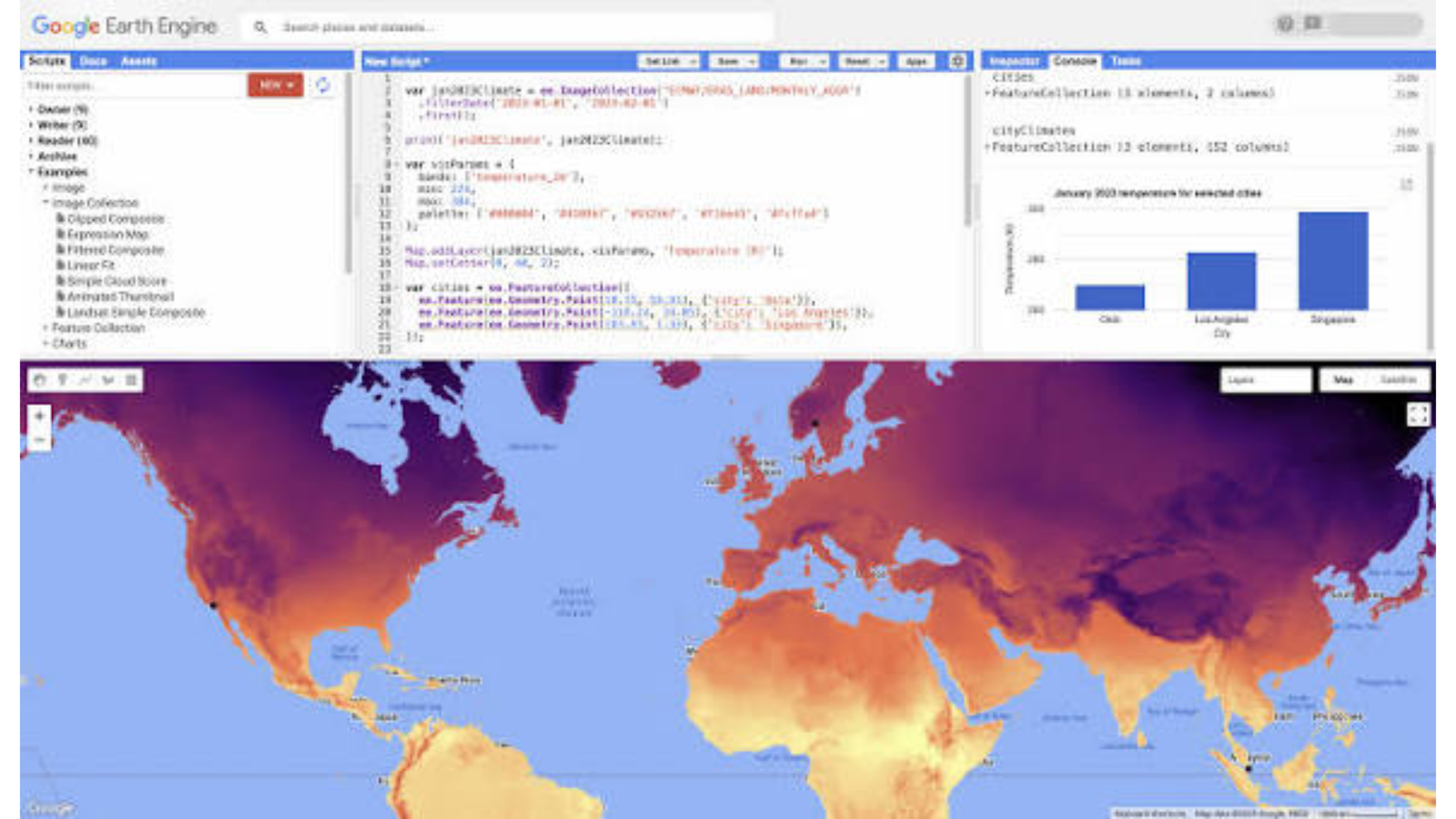
Google Earth Engine is a cloud platform for analyzing satellite imagery and geospatial data at a massive scale. It stores decades of imagery from satellites like Landsat and Sentinel, along with climate, elevation, and land cover datasets. Instead of downloading huge files, you run your analysis on Google’s servers and get results in minutes.
You work through a browser-based Code Editor using JavaScript, or through a Python API. That means some coding is involved, but the payoff is big. You can calculate NDVI across an entire country, run change detection over 30 years, or build land cover classification models without worrying about storage.
Earth Engine is free for many research, education, and non-commercial uses, while commercial use requires a paid plan. That makes it one of the best options for students and researchers who need serious power on a small budget.
What Makes Google Earth Engine Stand Out
- Huge catalog of ready-to-use satellite imagery and geospatial datasets
- Cloud processing, so no powerful computer is needed
- JavaScript Code Editor and Python API for scripting and automation
- Great for time series, NDVI, and change detection
- Free access for many non-commercial users
Things to Consider
Earth Engine has a learning curve, especially if you have never written code. It is not built for traditional map design, so most people export results to QGIS or another tool for final maps. You also need an internet connection, and commercial users must check current pricing and terms on the official site.
- Best For: Researchers, students, and analysts working with large satellite datasets
- Platform: Web (browser-based)
- Pricing: Free for eligible non-commercial use; paid for commercial use
If you want to analyze the whole planet without buying a supercomputer, Earth Engine is hard to beat.
19. Sentinel Hub / EO Browser: Quick, Easy Satellite Imagery Viewing Online
EO Browser is a free web tool for searching and viewing satellite images from Sentinel, Landsat, and other missions. You pick a place on the map, choose a date, and see the imagery within seconds. No download, no installation, and no coding.
Beyond simple viewing, it includes built-in visualizations and spectral indices like NDVI, so you can check vegetation health, water, or burned areas with a few clicks. A time-lapse feature lets you watch how a location changes over months or years, which is great for quick change detection and for showing results to non-technical audiences.
For developers, the Sentinel Hub platform behind it offers APIs for building custom applications. The browser viewer is free, while heavier API usage is offered through paid plans.
What Makes EO Browser Stand Out
- Free, browser-based satellite imagery viewer
- Built-in NDVI and other spectral index visualizations
- Time-lapse tool for spotting changes over time
- Easy to use, with no coding or installation
- APIs available for custom apps
Things to Consider
EO Browser is mainly for viewing and quick analysis, not full geoprocessing. You cannot run advanced spatial analysis or detailed cartography inside it. API plans and usage limits can change, so check the official site for current terms.
- Best For: Beginners, students, and anyone who needs quick satellite imagery
- Platform: Web (browser-based)
- Pricing: Free viewer; paid API plans
If you just need to see what a place looked like from space, EO Browser gets you there fast.
20. Microsoft Planetary Computer: Open, Cloud-Native Geospatial Data and APIs
Microsoft Planetary Computer is a platform that gives access to a large catalog of environmental and satellite datasets. It is built on open standards, especially STAC (SpatioTemporal Asset Catalog), which makes it easier to search and load data through code.
Developers and data scientists use it to pull imagery, climate data, and land cover layers directly into their Python workflows. It works with common tools like GDAL, Rasterio, and Xarray, and it fits neatly into modern cloud-native geospatial pipelines.
It is not a click-and-map tool. Think of it as a data and API platform for people who are comfortable with code and want open, well-organized data at scale.
What Makes Microsoft Planetary Computer Stand Out
- Large catalog of open environmental and satellite datasets
- Built on the open STAC standard
- Works with Python tools like GDAL, Rasterio, and Xarray
- Designed for scalable, cloud-native workflows
- Free data access for developers and researchers
Things to Consider
It is aimed at technical users and has a steep learning curve for beginners. There is no traditional map interface for visual editing. Features and hosted compute options have changed over time, so check Microsoft’s official documentation for what is currently available before building a workflow around it.
- Best For: Developers, data scientists, and researchers comfortable with Python
- Platform: Web and API
- Pricing: Free data access (check current terms for compute options)
If you like working in code and want open, well-organized data, Planetary Computer is a strong addition to your toolkit.
21. Google Earth Pro: Simple, Free Visualization and Historical Imagery
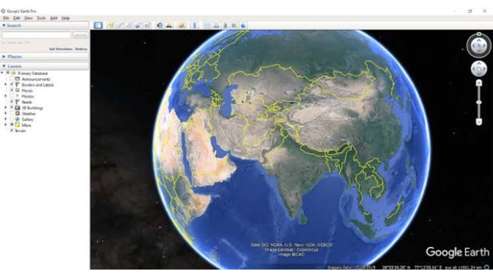
Google Earth Pro is one of the easiest tools for exploring the world. It is free, works on Windows, Mac, and Linux, and gives you detailed satellite imagery, 3D terrain, and buildings you can fly over from your desktop. It is also a handy pick for people searching for GIS software for Mac that costs nothing. Looking for other options? See our list of the best Google Earth alternatives.
Its biggest strength is historical imagery. A time slider lets you go back in years to see how a city grew, a coastline shifted, or a forest was cleared. You can also measure distances and areas, draw lines and polygons, and add placemarks with notes.
Earth Pro works with KML and KMZ files, and it can import spreadsheets and some GIS data, so you can overlay your own layers. It is not designed for deep spatial analysis, but it is excellent for quick checks, presentations, and site visits before deeper work in QGIS or ArcGIS.
What Makes Google Earth Pro Stand Out
- Free and easy to learn
- Historical satellite imagery with a time slider
- Measure distances and areas with built-in tools
- Import and export KML and KMZ files
- Works on Windows, Mac, and Linux
Things to Consider
Earth Pro has no real geoprocessing or spatial analysis tools. Imagery dates and quality vary by location, and it is meant for visualization rather than professional map production. Check Google’s site for current availability and features.
- Best For: Beginners, students, educators, and quick location research
- Platform: Windows, macOS, Linux
- Pricing: Free
Earth Pro is the perfect starting point for exploring a location before you begin serious GIS work.
22. ArcGIS Online: Web GIS Software for Building and Sharing Maps
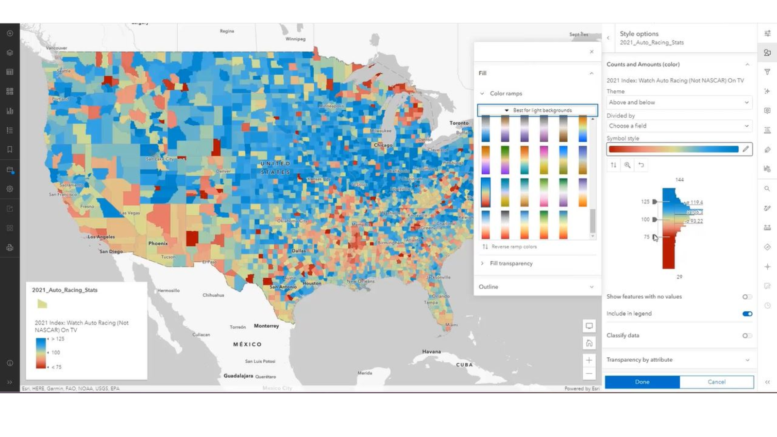
ArcGIS Online is Esri’s cloud platform for creating, managing, and sharing maps. It connects directly with ArcGIS Pro, so you can publish your desktop work to the web and let others view it from any browser without installing anything. Want the full picture? Read our overview of ArcGIS Online features, benefits, and use cases, or see how it compares in ArcGIS Enterprise vs ArcGIS Online.
With its map viewer, you can build interactive web maps, style layers, and add pop-ups. You can import and export GeoJSON files for easy data sharing. Dashboards turn live data into charts and maps for decision-makers, and StoryMaps help you combine text, images, and maps into clear stories. It also includes a large library of ready-made basemaps and datasets.
It is a strong choice for teams and organizations that need secure sharing and collaboration. The main trade-off is cost, since full access requires a paid subscription based on users and credits.
What Makes ArcGIS Online Stand Out
- Easy web map creation and sharing
- Dashboards and StoryMaps for presenting results
- Direct connection with ArcGIS Pro
- Large library of basemaps and datasets
- Team collaboration and access controls
Things to Consider
ArcGIS Online is paid, and the credit-based pricing can be confusing for new users. Some analysis tools consume credits, so costs can grow with heavy use. Free options are limited, so review Esri’s current plans before choosing.
- Best For: Organizations, teams, and anyone sharing maps with non-GIS users
- Platform: Web (browser-based)
- Pricing: Paid subscription (free trial available)
If your goal is to get maps in front of decision-makers quickly, ArcGIS Online makes sharing simple.
Quick pick: Choose Google Earth Engine for large-scale analysis, EO Browser for quick imagery, Microsoft Planetary Computer for open data and APIs, Google Earth Pro for free visualization, and ArcGIS Online for team map sharing.
Best Drone Mapping, LiDAR, and Photogrammetry Software
Drones have changed how we collect spatial data. A small drone can capture hundreds of overlapping photos in one flight, and the right software turns them into accurate maps and 3D models. This is where photogrammetry and LiDAR tools come in. Not sure which sensor suits your project? Read our guide to photogrammetry vs LiDAR. These tools create products like orthomosaics, DEMs, and point clouds that you can bring into QGIS or ArcGIS for further analysis. The four tools below are the best drone mapping software and point cloud options for surveys, construction, farming, and research.
23. Pix4D: Popular Drone Mapping Software for Maps and 3D Models
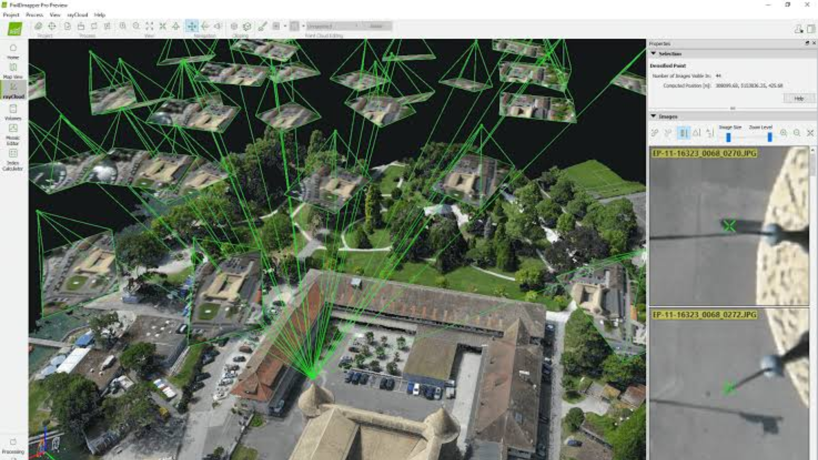
Pix4D is one of the best-known names in drone mapping software. It takes overlapping photos from a drone and turns them into georeferenced maps, 3D models, and elevation data. Surveyors, farmers, and construction teams use it to measure sites, track progress, and check crop health.
The workflow is straightforward. You upload your images, choose a processing template, and the software builds an orthomosaic, a DEM, and a point cloud. It also supports ground control points, which improve accuracy when you need survey-grade results. Pix4D offers several products for different needs, including tools for mapping, agriculture, and cloud-based projects. Esri users may also want to look at ArcGIS Drone2Map.
Results export easily to common GIS and CAD formats, so you can move your data into your main GIS software. It is a paid product with subscription options, and it is a good pick for teams that want reliable results without building their own workflow.
What Makes Pix4D Stand Out
- Creates orthomosaics, DEMs, and point clouds from drone photos
- Ready-made processing templates for common jobs
- Support for ground control points for better accuracy
- Several products for mapping, agriculture, and cloud collaboration
- Exports to common GIS and CAD formats
Things to Consider
Pix4D is a paid, subscription-based tool, and costs can add up for small teams. Processing large projects needs a strong computer with plenty of memory. Product names, features, and plans change over time, so check the vendor’s site for what is currently offered and whether a free trial is available.
- Best For: Surveyors, agriculture and construction teams, and professional drone pilots
- Platform: Windows, macOS (varies by product)
- Pricing: Paid subscription
If you want dependable drone mapping results with a proven workflow, Pix4D is a solid choice.
24. Agisoft Metashape: Flexible Photogrammetry Software for Point Clouds and 3D Models
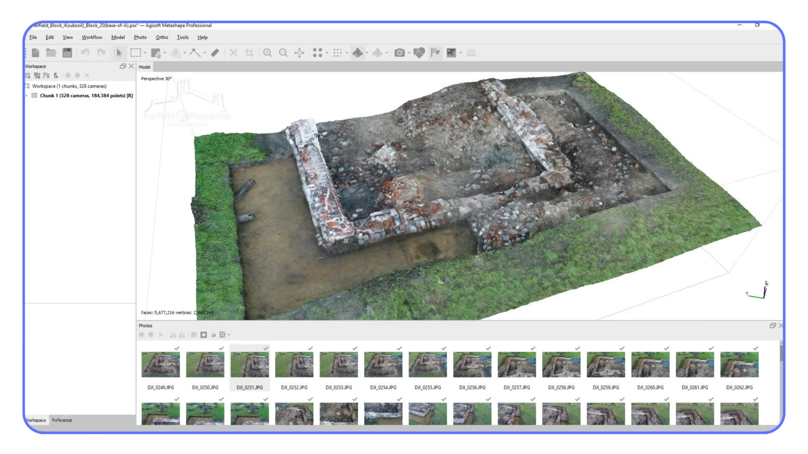
Agisoft Metashape is a powerful photogrammetry tool that turns photos into detailed 3D models, point clouds, and maps. It is popular with professionals and researchers because it gives you a lot of control over each step of processing.
You can work with drone images, but also with photos from the ground or from other cameras. That makes it useful for many fields beyond mapping, including archaeology, heritage documentation, and film. The software builds dense point clouds, textured 3D meshes, DEMs, and orthomosaics, and it lets you classify points and edit results before export.
Metashape comes in a Standard and a Professional edition. The Professional edition adds features for GIS work, such as georeferencing tools and Python scripting, which is helpful for scripting and automation of repeat jobs. Educational discounts are usually available.
What Makes Agisoft Metashape Stand Out
- Builds point clouds, 3D meshes, DEMs, and orthomosaics
- Works with drone, ground, and other photo sources
- Detailed control over processing settings
- Python scripting in the Professional edition
- Runs on Windows, macOS, and Linux
Things to Consider
Metashape asks for more hands-on decisions than one-click tools, so beginners may need time to learn the settings. Large projects require a powerful computer, ideally with a good graphics card. Check the vendor’s site for current edition features, pricing, and discounts.
- Best For: Surveyors, researchers, and professionals who want control over processing
- Platform: Windows, macOS, Linux
- Pricing: Paid license (education discounts often available)
Metashape rewards users who like to fine-tune their results, and it fits a wide range of photogrammetry projects.
25. OpenDroneMap: Free, Open Source Drone Image Processing
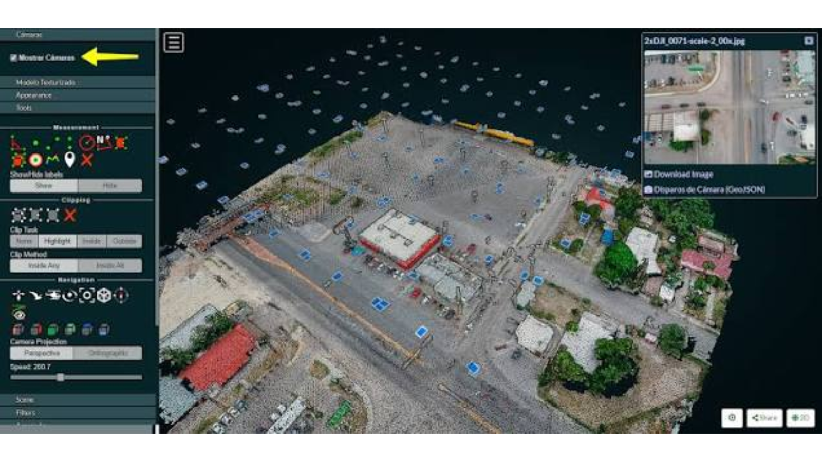
OpenDroneMap (ODM) is a free and open source project for processing drone images. If paid tools are out of your budget, it is one of the best free options for creating maps and 3D models from aerial photos.
ODM produces the same kinds of outputs as commercial tools: orthomosaics, point clouds, DEMs, and textured 3D models. Most people use it through WebODM, a browser-based interface that makes it easier to upload photos, run processing jobs, and view results on a map. You can install it on your own computer or server, or use a paid hosted option if you don’t want to manage the setup.
Because it is open source, the community keeps improving it, and it works well alongside QGIS for final map layouts and analysis. It is a great option for students, NGOs, and small teams who want drone mapping without license fees.
What Makes OpenDroneMap Stand Out
- Free and open source
- Creates orthomosaics, point clouds, DEMs, and 3D models
- WebODM gives a friendly browser-based interface
- Can run on your own computer or server
- Active community and good compatibility with QGIS
Things to Consider
Setup can be technical, since ODM is commonly installed through tools like Docker. Processing large datasets takes time and needs a computer with enough memory. Results may need more checking and tuning than commercial tools, and support comes mostly from the community. A hosted paid option exists if you prefer not to self-host, so check current details on the official site.
- Best For: Students, NGOs, small teams, and budget-conscious drone users
- Platform: Windows, macOS, Linux
- Pricing: Free and open source (paid hosted options available)
OpenDroneMap shows how far open source has come. If you can handle a little setup, you get professional-style outputs at no cost.
26. CloudCompare: Free Point Cloud Software for Viewing and Analysis
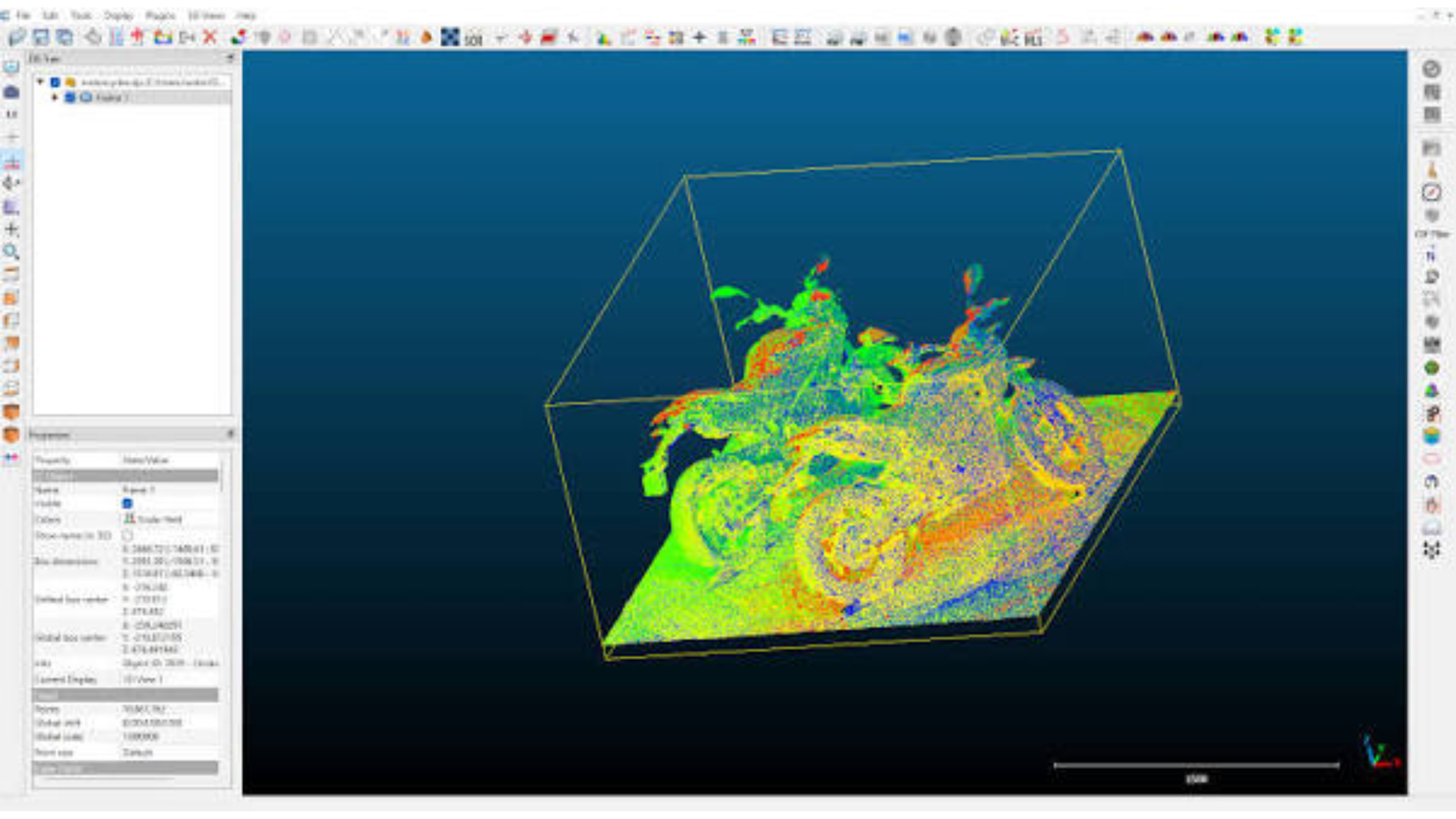
CloudCompare is a free, open source tool for working with 3D point clouds and meshes. It is widely used to inspect, clean, and compare LiDAR and photogrammetry data. If you have a large point cloud and need to understand it, this is the tool many professionals reach for.
It opens very large files smoothly and lets you view them from any angle. You can measure distances, clean noisy points, segment areas, and align two scans together. One of its best features is comparing two point clouds to measure change, such as how a slope, stockpile, or building has shifted over time.
CloudCompare also supports plugins, which extend it with extra tools for classification, surface analysis, and more. It is not a full GIS, so it does not replace tools like QGIS, but it pairs nicely with them for 3D work.
What Makes CloudCompare Stand Out
- Free and open source
- Handles very large point clouds
- Tools for cleaning, segmenting, and measuring
- Compares two point clouds to detect change
- Plugin support for extra features
Things to Consider
CloudCompare is focused on point clouds, so it lacks mapping, cartography, and full spatial analysis tools. The interface is technical, and some features are not obvious to new users. Learning takes practice, and support comes from the community and documentation.
- Best For: Surveyors, engineers, and researchers working with LiDAR and point cloud data
- Platform: Windows, macOS, Linux
- Pricing: Free and open source
If your work involves LiDAR or 3D scans, CloudCompare is an essential free tool to keep on hand.
Quick pick: Choose Pix4D for a proven drone mapping workflow, Agisoft Metashape for control and flexibility, OpenDroneMap for free drone processing, and CloudCompare for free point cloud analysis.
Best Developer and Spatial Database Tools
Some of the most powerful GIS tools have no traditional map window at all. They are libraries, databases, and servers that let you automate work, handle huge datasets, and build your own applications. If you are comfortable with code, these tools give you speed and flexibility that point-and-click software can’t match. The four below are the best GIS tools for developers, data scientists, and teams that need to scale.
27. Python Geospatial Stack (GDAL, Rasterio, GeoPandas): The Free Toolkit for Automating Spatial Workflows
Python is now one of the most popular languages in GIS, and its geospatial libraries make it easy to build custom workflows. New to the language? Start with our guide to the power of Python in GIS. Instead of one program, you get a set of tools that work together.
GDAL is the foundation. It reads and writes hundreds of raster and vector formats, including GeoTIFF, shapefile, and GeoJSON, and it powers many other GIS programs behind the scenes. Rasterio makes working with raster data simpler, so you can read satellite images, calculate NDVI, or clip a DEM in a few lines of code. GeoPandas does the same for vector data, letting you treat spatial data like a table and run overlay analysis, buffers, and joins quickly.
The real benefit is scripting and automation. A task that takes an hour of clicking can run in seconds, and you can repeat it on hundreds of files. Python integration also connects GIS with data science tools like pandas and machine learning libraries.
What Makes the Python Stack Stand Out
- Free and open source
- GDAL reads and writes hundreds of spatial data formats
- Rasterio for raster data, GeoPandas for vector data
- Automates repeat tasks across many files
- Connects easily with data science and machine learning tools
- Huge community and lots of free tutorials
Things to Consider
You need to know some Python, so the learning curve is steeper than with QGIS. Installing GDAL and its dependencies can be tricky on some systems, and using a tool like conda can help. There is no built-in map interface, so most people use it alongside QGIS or a notebook for visual checks.
- Best For: Developers, data scientists, and analysts who want to automate GIS work
- Platform: Cross-platform (Windows, macOS, Linux)
- Pricing: Free and open source
If you want to save hours on repeated tasks, learning the Python geospatial stack is one of the best investments you can make.
28. R (terra and sf): Free Software for Statistical and Spatial Analysis
R is a programming language built for statistics, and its spatial packages make it a strong choice for analysis. Two packages do most of the heavy lifting. The sf package handles vector data using the simple features standard, and the terra package handles raster data, including large satellite images.
What sets R apart is how naturally spatial data fits with statistics. You can run geostatistics, spatial regression, and modeling in the same environment where you clean your data and draw your charts. Packages like ggplot2 and tmap help you create clear, publication-quality maps.
R is very popular in universities, ecology, public health, and social science research. If your goal is to understand patterns and test ideas, not just draw maps, R gives you the statistical depth many GIS programs lack.
What Makes R (terra and sf) Stand Out
- Free and open source
- sf for vector data and terra for raster data
- Strong geostatistics and spatial modeling tools
- Publication-quality maps with ggplot2 and tmap
- Popular in research, with many free learning resources
Things to Consider
R has a learning curve, especially if you are new to coding. Very large raster jobs need careful memory management, though terra handles this better than older packages. It is also less suited than Python for building web apps or production pipelines.
- Best For: Researchers, statisticians, and analysts who need spatial statistics
- Platform: Cross-platform (Windows, macOS, Linux)
- Pricing: Free and open source
If your work leans toward statistics and research, R turns GIS into a full analysis environment.
29. PostGIS + GeoServer: Open Source Spatial Database and Web Map Publishing
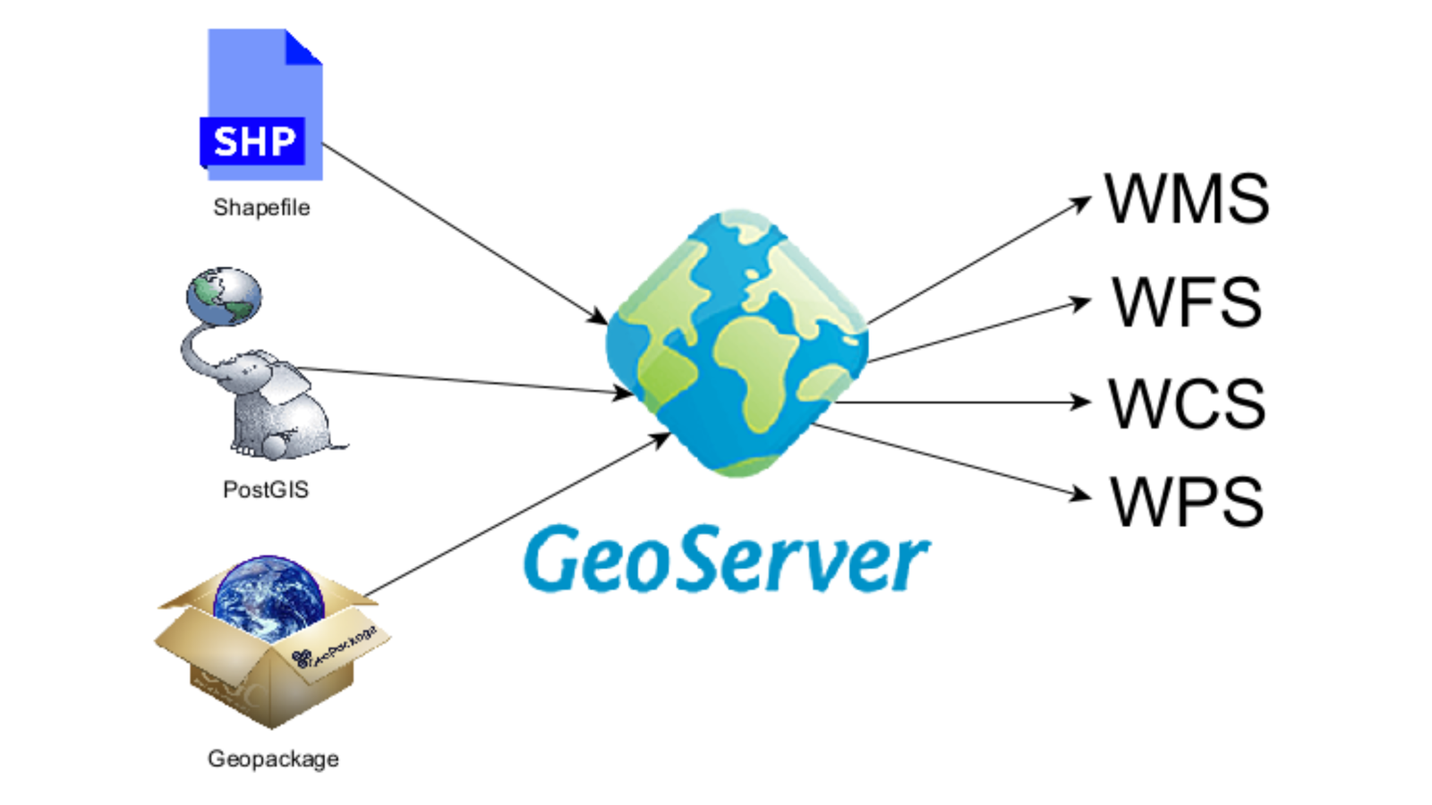
PostGIS and GeoServer work as a team. PostGIS adds spatial abilities to PostgreSQL, one of the most trusted open source databases. GeoServer then publishes that data to the web so other people and apps can use it.
PostGIS turns a regular database into a full spatial database. It stores points, lines, and polygons, and lets you run spatial queries in SQL, such as finding all parcels within 500 meters of a river. It supports raster data too, and it handles millions of records with speed. Many organizations use it as the central home for their geodatabase.
GeoServer sits on top and shares your data using open standards like WMS and WFS. That means QGIS, web maps, and other apps can load your data live. Together, they give you a complete, free system for storing, analyzing, and sharing spatial data, and they are a common open source alternative to enterprise server products.
What Makes PostGIS + GeoServer Stand Out
- Free and open source
- PostGIS adds spatial queries to a powerful database
- Handles very large datasets reliably
- GeoServer publishes maps and data using open standards
- Works smoothly with QGIS and web mapping libraries
- Well suited to multi-user teams
Things to Consider
This is a server setup, not a desktop app, so it needs some database and IT knowledge. Installation, security, and maintenance take time. Beginners may find SQL and server settings hard at first. For a single user working on small projects, it may be more than you need.
- Best For: Organizations, developers, and teams managing shared spatial data
- Platform: Cross-platform (Windows, macOS, Linux)
- Pricing: Free and open source
If your team needs one reliable home for its spatial data and a way to share it online, this pair is hard to beat.
30. WhiteboxTools: A Fast, Free Engine for Terrain and Hydrology Analysis
WhiteboxTools is an open source geospatial analysis engine created by Dr. John Lindsay at the University of Guelph. It is built for speed, and it packs hundreds of tools into a single lightweight program.
It shines in terrain analysis and hydrological modeling. You can fill depressions in a DEM, map flow paths, extract stream networks, and delineate watersheds. It also includes tools for LiDAR processing, raster data analysis, and image processing, so it covers a lot of ground for a free tool.
You can use WhiteboxTools in several ways. It runs from the command line, and it has a Python package and an R package for scripting and automation. There is also a QGIS plugin, so you can run its tools inside a familiar interface. It does not include map design or cartography tools, so most people use it as an analysis engine and pair it with QGIS for final maps.
What Makes WhiteboxTools Stand Out
- Free and open source
- Hundreds of tools for terrain, hydrology, and LiDAR
- Fast processing with a lightweight design
- Works from the command line, Python, R, and QGIS
- Good for automating repeat analysis
Things to Consider
WhiteboxTools has no full mapping interface, so it is not an all-in-one GIS. Beginners may need time to learn which tool to use for each job. Documentation is helpful, but the wide range of tools can feel overwhelming at first.
- Best For: Hydrologists, terrain analysts, and researchers working with DEMs and LiDAR
- Platform: Windows, macOS, Linux
- Pricing: Free and open source
WhiteboxTools gives you serious terrain analysis power without the cost. It fits neatly into a workflow with QGIS, Python, or R.
Quick pick: Choose the Python stack for automation, R for spatial statistics, PostGIS + GeoServer for shared databases and web publishing, and WhiteboxTools for fast terrain and hydrology analysis.
Best GIS Software by Use Case
Not sure which tool fits your work? This quick guide matches the best GIS software applications to common needs. Every tool below appears in the list above, so you can jump back to its full review.
Best GIS Software for Students and Beginners
Students need tools that are free, easy to learn, and well supported by tutorials. Once you pick a tool, our list of free GIS courses can help you learn it.
- QGIS: The best free GIS software to start with, backed by a huge library of learning resources.
- Google Earth Pro: A simple way to explore places and see historical imagery.
- Google Earth Engine: Free for many non-commercial uses, and great for learning remote sensing with real satellite data.
- SNAP: Free tools for Sentinel imagery, useful for coursework and thesis projects.
Best GIS Software for Urban Planning
Planners work with parcels, roads, zoning, and population data, so they need strong geodatabase and mapping tools. See how these tools are used in practice in our article on geospatial analysis in urban planning.
- ArcGIS Pro: The most complete option for large planning departments.
- QGIS: A capable free alternative for smaller teams and consultants.
- ArcGIS Online: Helpful for sharing maps and dashboards with the public and decision-makers.
Best GIS Software for Agriculture
Farming projects rely on imagery, crop health indices like NDVI, and drone data. Learn more about the role of GIS in agriculture.
- Pix4D: Turns drone photos into maps for field monitoring.
- ENVI: Deep multispectral and hyperspectral analysis for precision agriculture research.
- Google Earth Engine: Tracks vegetation and rainfall trends across large areas and many years.
- OpenDroneMap: A free way to process drone images on a tight budget.
Best GIS Software for Environmental Analysis
Environmental work often combines terrain, water, land cover, and change over time.
- GRASS GIS: Strong raster and hydrological modeling tools.
- SAGA GIS and WhiteboxTools: Fast terrain analysis, flow paths, and watershed mapping.
- TerrSet: Land change modeling and prediction.
- SNAP and SCP for QGIS: Free options for land cover classification and change detection.
Best GIS Software for Spatial Analysis and Research
Researchers need statistical depth and repeatable workflows.
- R (terra and sf): Ideal for geostatistics and spatial modeling.
- Python stack (GDAL, Rasterio, GeoPandas): Best for scripting and automation.
- ArcGIS Pro: A strong choice when your institution already has a license.
Best GIS Software for Drone Mapping and LiDAR
- Pix4D and Agisoft Metashape: Reliable paid options for orthomosaics and point clouds.
- OpenDroneMap: The best free drone mapping software.
- CloudCompare: A free tool for cleaning and comparing point clouds.
- Global Mapper: A budget-friendly pick for LiDAR and terrain.
Best GIS Software for Mac Users
Many desktop GIS programs are built for Windows only, so Mac users have fewer options.
- QGIS: Runs natively on macOS.
- Google Earth Pro: Available for Mac at no cost.
- GRASS GIS and SNAP: Both support macOS.
- Cloud platforms: Earth Engine and ArcGIS Online run in a browser, so your operating system doesn’t matter.
Always check each vendor’s site for current macOS support before installing.
Best GIS Software for Business and Location Intelligence
- MapInfo Pro: Geocoding and thematic mapping for business teams.
- ArcGIS Online: Easy sharing of dashboards with non-GIS colleagues.
Free vs. Paid GIS Software: Which Should You Choose?
This is the question almost everyone asks. The honest answer is that both have a place. The best GIS software for you depends on your budget, your team, and how much support you need.
When Free and Open Source GIS Software Is Enough
Free tools are a smart choice when:
- You are a student, hobbyist, or independent researcher.
- Your projects involve everyday mapping, data editing, and standard spatial analysis.
- You are comfortable finding help through forums, tutorials, and community guides.
- You want to avoid license costs or vendor lock-in.
Tools like QGIS, GRASS GIS, and the Python stack cover most tasks that people once needed paid software for. Many organizations now run large workflows entirely on open source GIS software.
When Paid GIS Software Is Worth the Cost
Paid GIS software earns its price when:
- Your organization needs official support, training, and service guarantees.
- You work in a team that shares data and needs strict access controls.
- Your industry expects certain formats, workflows, or certified tools.
- Your job depends on specialist features, like hyperspectral analysis in ENVI or utility network tools in enterprise platforms.
If you are comparing GIS software pricing, remember that the cost is not only the license. Training time, hardware, and support all matter, so look at the full picture. For Esri’s plans specifically, see our breakdown of ArcGIS pricing plans.
Free vs. Paid at a Glance
| Factor | Free / Open Source | Paid / Proprietary |
|---|---|---|
| Cost | No license fees | Subscription or license fees |
| Support | Community forums and tutorials | Vendor help desk and training |
| Ease of Use | Varies; some have a learning curve | Often polished, with guided workflows |
| Customization | Highly flexible, with plugins and extensions | Flexible within vendor tools |
| Team Features | Possible with extra setup | Often built in |
| Best For | Students, researchers, small teams | Enterprises, agencies, regulated industries |
QGIS vs. ArcGIS: A Quick Look
This is the most common comparison in GIS. QGIS is free, open source, runs on Windows, Mac, and Linux, and has a huge plugin library. ArcGIS Pro offers a deeper built-in toolset, official support, and tight integration with ArcGIS Online, but it costs more and runs on Windows only. For many users, QGIS is the best free alternative to ArcGIS. For large organizations, ArcGIS Pro’s support and ecosystem can justify the price.
The Smart Middle Path: Use Both
You don’t have to choose one side. Many professionals build a hybrid toolkit: QGIS for daily mapping, plus one specialist tool for a specific need, such as ENVI for spectral analysis, Pix4D for drone mapping, or ArcGIS Pro when a client requires it. Before you buy anything, take advantage of free trials and test each tool on a real project.
How to Choose the Right GIS Software
With 30 options, picking one can feel like a lot. The good news is you don’t need to compare every feature. Answer a few simple questions and the list shrinks fast.
1. Start With Your Data Type
Different tools are built for different data. Know your formats first, whether that is a shapefile, a raster, or a point cloud, and make sure you understand your coordinate systems.
- Vector data (roads, boundaries, parcels): QGIS, ArcGIS Pro, or MapInfo Pro.
- Raster and satellite imagery: ENVI, SNAP, or Google Earth Engine.
- LiDAR and point clouds: Global Mapper or CloudCompare.
- Drone photos: Pix4D, Agisoft Metashape, or OpenDroneMap.
- Large databases: PostGIS with GeoServer.
2. Match the Tool to Your Project Size
A student mapping one neighborhood has different needs from a utility company managing millions of assets. For small projects, free desktop GIS software is usually enough. For team projects with shared data and strict access rules, look at enterprise platforms or a spatial database setup.
3. Check System Requirements
Before you download anything, look at the operating system and hardware needs. Some tools, like ArcGIS Pro, run on Windows only. Others, like QGIS, work on Windows, Mac, and Linux. Imagery and drone software can need a lot of memory and a strong graphics card. If your computer is modest, cloud-based GIS platforms move the heavy work to remote servers.
4. Think About the Learning Curve
Be honest about your skill level.
- Beginners: QGIS, Google Earth Pro, or EO Browser.
- Intermediate users: ArcGIS Pro, SNAP, or Global Mapper.
- Advanced or technical users: GRASS GIS, the Python stack, R, or PostGIS.
A powerful tool you can’t learn quickly won’t help a project with a deadline.
5. Look at Scripting and Extensions
If you repeat the same tasks often, scripting and automation will save you hours. Check whether the software supports Python integration, batch processing, or plugins and extensions. QGIS and ArcGIS Pro both do, and so do most of the developer tools in this list.
6. Compare Support and Community
Paid tools usually include a help desk and official training. Free tools rely on communities, forums, and tutorials. A large, active community is a real advantage, so check how much learning material exists before you commit.
7. Test Before You Commit
Almost every paid tool offers a free trial or a limited version, and every open source tool is free to install. Test two or three options on a real project from your own work. You will learn more in one afternoon than from any comparison table.
Quick decision guide
- On a tight budget? Start with QGIS.
- Working with satellite imagery? Try SNAP or Google Earth Engine.
- Mapping with drones? Try OpenDroneMap or Pix4D.
- Need enterprise support? Choose ArcGIS Pro.
- Love automation? Learn the Python stack.
FAQs About the Best GIS Software Applications
What is the best free GIS software?
QGIS is the best free GIS software for most people. It is open source, runs on Windows, Mac, and Linux, and supports a huge range of plugins. GRASS GIS and SAGA GIS are strong free options for deeper analysis, and Google Earth Engine is free for many non-commercial uses.
QGIS vs ArcGIS: which is better?
It depends on your needs. QGIS is free, flexible, and works across operating systems. ArcGIS Pro offers a deeper built-in toolset, official support, and tight integration with ArcGIS Online, but it costs more and runs on Windows only. Individuals often prefer QGIS, while large organizations often choose ArcGIS.
What is the best GIS software for Mac?
QGIS is the best choice for Mac users because it runs natively on macOS at no cost. Google Earth Pro, GRASS GIS, and SNAP also support Mac. Cloud tools like Google Earth Engine and ArcGIS Online work in any browser, so your operating system doesn’t matter.
Which software is best for remote sensing analysis?
ENVI is a top choice for spectral analysis, while SNAP is the best free option for Sentinel and radar data. Google Earth Engine is ideal for large-scale, cloud-based analysis. Beginners can use the Semi-Automatic Classification Plugin in QGIS for land cover classification.
Do I need coding skills to use GIS software?
No. Tools like QGIS, ArcGIS Pro, and Google Earth Pro work through menus and buttons. Coding helps if you want to automate tasks or use tools like Google Earth Engine, R, or Python, but you can do a lot of useful mapping without writing any code. When you are ready to learn, see our guide to GIS programming.
Can I use GIS software online without installing anything?
Yes. Cloud-based GIS platforms like ArcGIS Online, EO Browser, and Google Earth Engine run in your browser. They are useful for quick maps, satellite imagery, and sharing results, though advanced analysis and detailed cartography are usually better in desktop software.
Conclusion
The best GIS applications are the ones that fit your data, your budget, and your skills, and the top GIS software on this list covers every level, from beginner to enterprise. We covered 30 of the best GIS software applications across desktop, open source, remote sensing, cloud, drone, and developer tools.
Here is the short version. QGIS is the best free all-rounder. ArcGIS Pro is the enterprise standard. ENVI leads in spectral analysis, Google Earth Engine leads in cloud-scale imagery, and OpenDroneMap is the best free drone option. Not sure where to begin? Install QGIS, add one specialist tool when your projects demand it, and use free trials to test paid options before you spend anything.
Ready to build your skills? Start with our guide to the 5 key skills in GIS, or explore our overview of GIS components and applications.
Last updated: [Month Year]. Prices, features, and platform support change often, so always confirm details on the official website.