GIS Blogs

Land Terminologies – پٹوار

In Pakistan, land ownership and management are crucial aspects of rural life, overseen by local officials known as Patwaris. These village accountants play a vital role in maintaining accurate records of land parcels, documenting ownership details, and collecting land revenue. Each piece of land is identified by unique numbers called Khewat and Khasra numbers, which … Read more
Top 15 Python Libraries for GIS

Python Libraries for GIS and Mapping Python libraries are great tools for GIS because they help you do a lot more with it. Using Python libraries, you can go beyond the basics of GIS and explore more advanced data science. Today, we’re focusing on Python libraries in GIS. What are the most popular Python packages … Read more
GIS File Formats

GIS Formats: Don’t Get Confused! Dealing with unknown GIS file formats can be frustrating for GIS analysts. But don’t worry, we’ve got you covered! We’ve made a list of many GIS formats to help you out. Some GIS formats are used a lot, while others are not as common. Let’s start by looking at the … Read more
Download High Resolution Satellite Images Free

Exploring the World with SAS Planet Nowadays, exploring the world is easier than ever because of digital technology. With advanced maps and satellite imagery, we can travel around the globe without leaving home. SAS Planet is a program that lets you see high-resolution satellite images and maps from different sources. In this article, we will … Read more
GIS Freelancing: Is It Possible?

Thinking about making extra money with GIS? I’m not super excited about freelance GIS work. There are some downsides, like no steady paycheck, no benefits, and no paid time off. That sounds pretty meh. But, despite all the negative stuff, there might be some good things about freelance GIS work. Let’s check it out and … Read more
Overlay Analysis in GIS

One of the most basic questions asked of a GIS (Geographic Information System) is “What’s on top of what?” For example: Before GIS, cartographers would make maps on clear plastic sheets and layer them on a light table to see how different data overlapped. Because overlaying data gives such valuable information, it was crucial for … Read more
Export an attribute table from ArcMap to Microsoft Excel
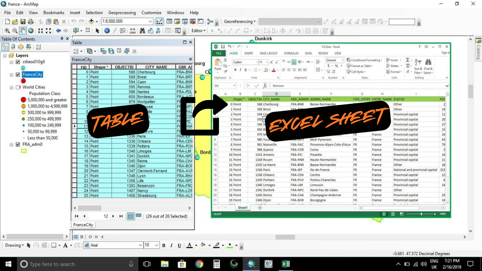
Summary The instructions tell you how to export an attribute table from ArcMap to Microsoft Excel. Procedure Use the Table to Excel tool in ArcMap Copy and paste all records from the attribute table into the Excel file Export the attribute table to a CSV file
Map Labels in ArcGIS Pro – 5 Tips and Tricks

I have a bit of a love-hate relationship with labeling. I love that it makes my maps clearer, but I hate how tedious it can be to place labels exactly where I want them. Hopefully, this article will help clear up some of the confusion. Labeling Basics in ArcGIS Pro In general, there are two … Read more
Tutorial: Get started with parcel fabric editing
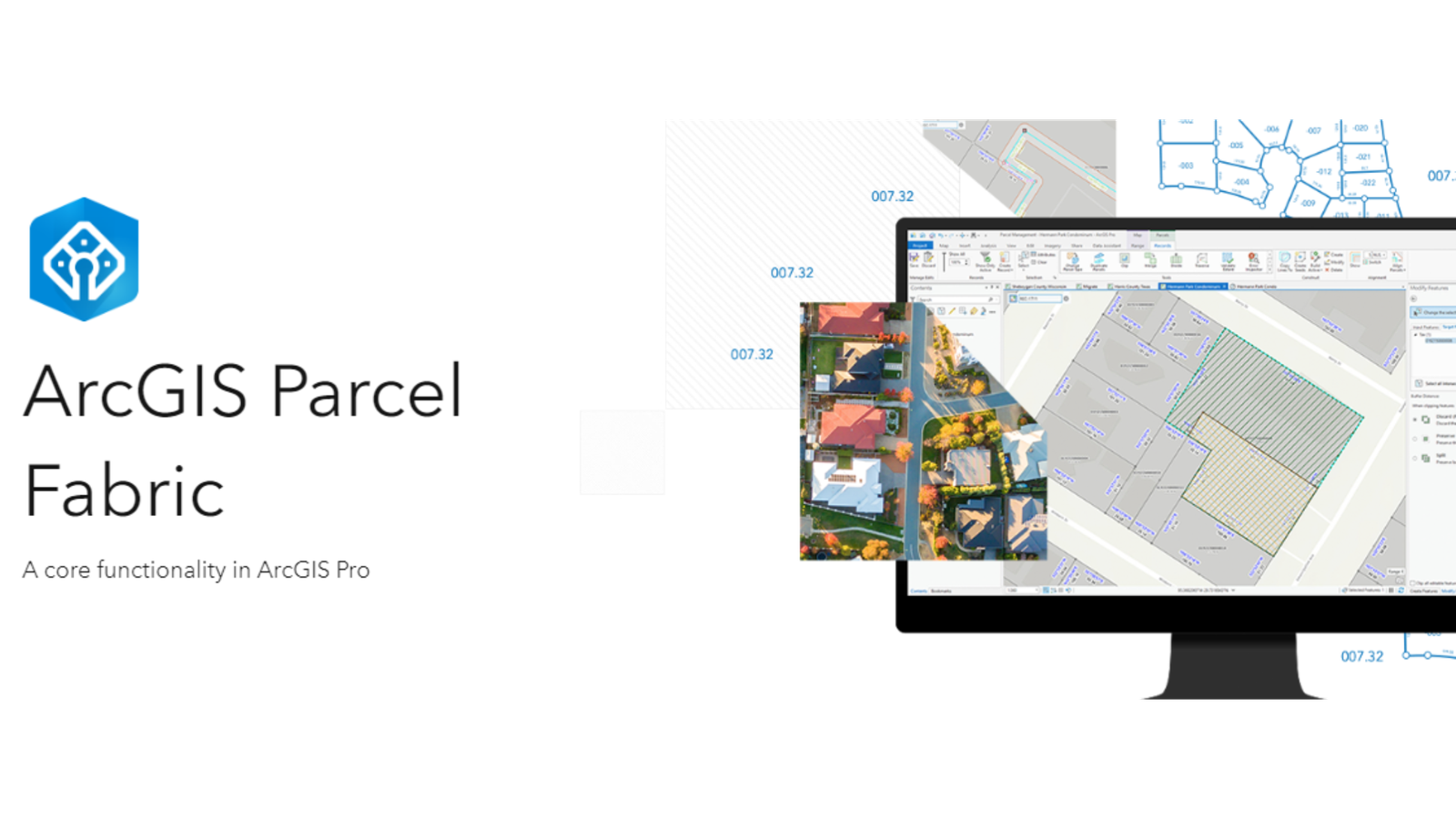
Level: Beginner What you’ll need: No extra files needed, it’s already on your computer! Where to find it: Look in your ArcGIS folder under “ArcGIS\ArcTutor\Parcel Editing”. What you’ll learn: This guide will show you the basics of editing parcels using a special tool called a “parcel fabric.” What we’ll do: You’ll practice opening and changing … Read more