ArcGIS Online is a versatile and user-friendly platform that enables users to explore, analyze, and share geographic data. One of the fundamental tasks in ArcGIS Online is adding layers, and this blog post will focus specifically on adding shapefile layers. Shapefiles are a popular geospatial data format used to represent vector data, including points, lines, and polygons. By adding shapefile layers to ArcGIS Online, you can enhance your maps and leverage the rich functionality offered by the platform. In this guide, we will walk you through the step-by-step process of adding shapefile layers in ArcGIS Online.
Step 1: Prepare Your Shapefile: Before you can add a shapefile to ArcGIS Online, you need to ensure that your shapefile is properly prepared. Follow these steps:
- Ensure that your shapefile consists of three essential files: .shp, .shx, and .dbf. These files contain the geometry, index, and attribute data, respectively.
- Store all the shapefile files in the same directory on your local machine.
- Verify that the coordinate system of your shapefile is correctly defined. It’s crucial to maintain the spatial reference for accurate visualization and analysis in ArcGIS Online.
Step 2: Sign in to ArcGIS Online: To begin adding shapefile layers, you must have an active ArcGIS Online account. If you don’t have one, sign up for a free account at ArcGIS Online.
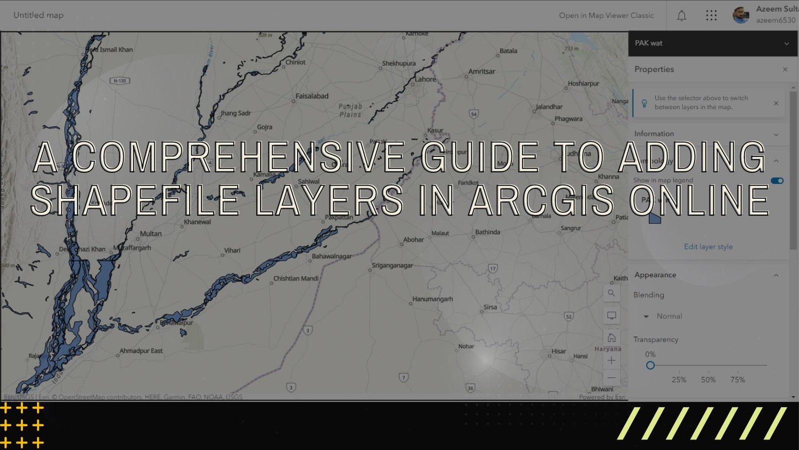
Step 3: Create a New Map: After signing in to your ArcGIS Online account, navigate to the ArcGIS Online home page. Click on the “Map” tab located at the top of the page to access the Map Viewer.
- In the Map Viewer, click on the “New Map” button to create a new map project.
- Give your map a descriptive name and specify any other required details, such as the basemap and initial extent.
Step 4: Add Shapefile Layer: Once you have created a new map, you can proceed to add your shapefile layer.
- In the Map Viewer, click on the “Add” button located on the toolbar. A dropdown menu will appear.
- From the dropdown menu, select the “Add Layer from File” option.
- In the “Add Layer from File” dialog box, click on the “Choose File” button and browse for your shapefile on your local machine.
- Select the shapefile (.zip file) and click on the “OK” button. ArcGIS Online will start uploading and processing the shapefile.
- Once the shapefile is successfully uploaded, it will appear as a new layer in your map.
- Optionally, you can customize the layer’s appearance, including symbology, labeling, and transparency, by clicking on the “Options” button next to the layer name.
Step 5: Configure Layer Properties: To further enhance your shapefile layer, you can configure its properties and settings.
- Click on the shapefile layer in the Contents pane on the left side of the Map Viewer.
- A set of options will appear. Here, you can change the layer’s name, visibility, transparency, and pop-up settings.
- You can also apply filters, define attribute-driven symbology, and enable clustering for better visualization.
Step 6: Save and Share Your Map: Once you have added and configured your shapefile layer, it’s time to save your map and share it with others.
- Click on the “Save” button located at the top of the Map Viewer.
- Provide a name and description for your map, and choose the appropriate sharing settings.
- You can share your map with specific individuals or groups, or make it publicly accessible.
- After saving, you can obtain a shareable link or embed the map in a website or application.
Adding shapefile layers in ArcGIS Online allows you to harness the power of geospatial data for mapping, analysis, and visualization. By following the step-by-step process outlined in this guide, you can effortlessly incorporate shapefiles into your ArcGIS Online projects. Explore the various customization options available to optimize your maps and effectively communicate spatial information. Start leveraging the capabilities of ArcGIS Online and unlock the potential of your shapefile data today.