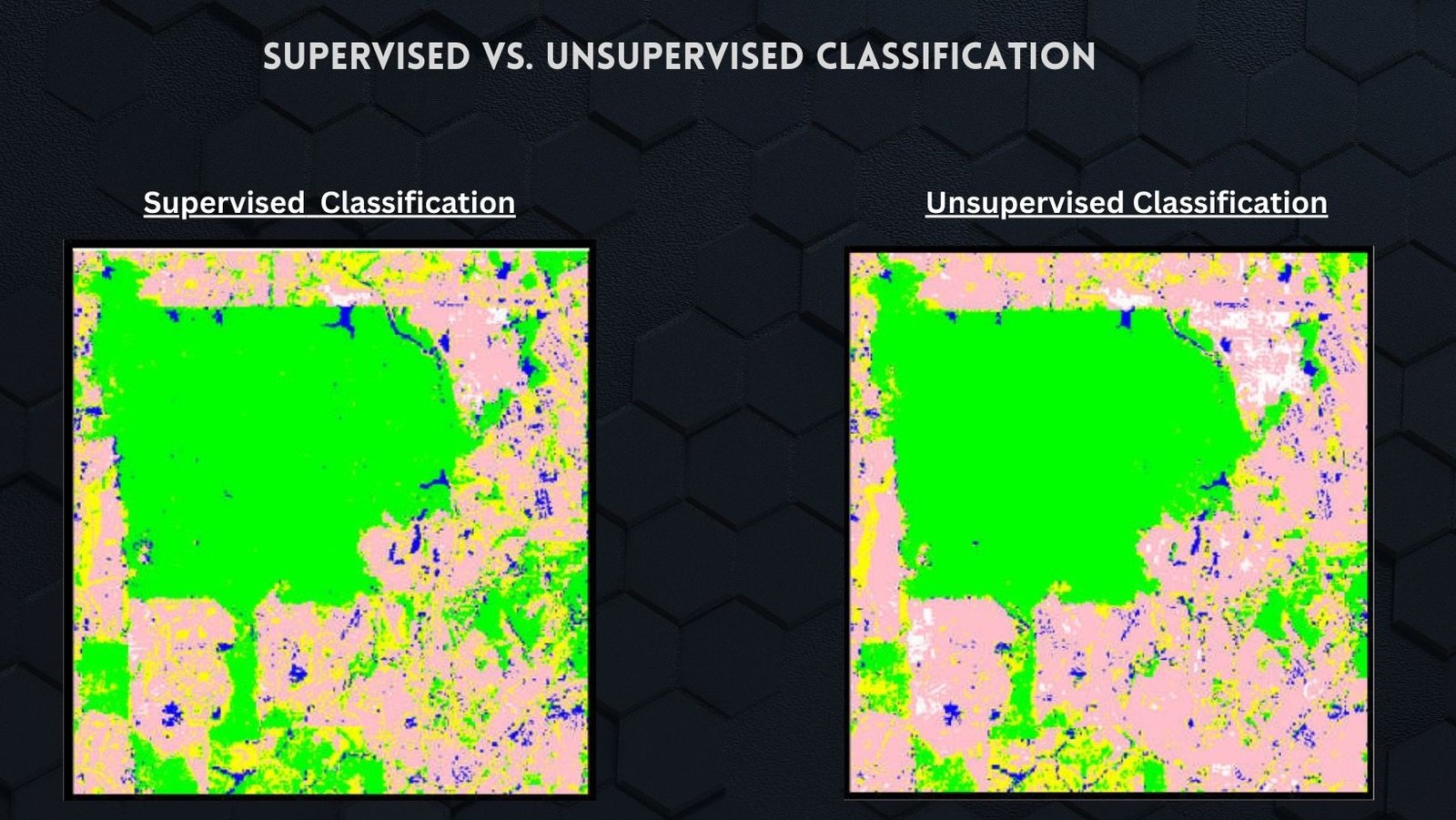
Download High-Resolution Satellite Images from SAS Planet
Satellite imagery has become an indispensable tool for a wide range of applications, including mapping, environmental monitoring, urban planning, and research. These images provide valuable …
Geographic Information Systems (GIS) have revolutionized various industries, and the medical field is no exception. GIS technology, which combines spatial data with advanced analytics, has …
Landuse mapping plays a crucial role in the sustainable development of any region, providing valuable insights into the distribution and utilization of land resources. Charsadda, …
Lidar is a remote sensing technology that uses light to measure distance to objects and surfaces. It is a powerful tool for collecting data about …
Introduction Cartography, the art and science of mapmaking, has played a pivotal role in human history for centuries. From ancient explorations to modern navigation systems, …
Geographic information systems (GIS) are computer-based tools that allow users to create, store, edit, analyze, and visualize spatial data. GIS has been used for decades …
Geographic Information Systems (GIS) have been increasingly used in various fields, including tourism. GIS technology provides an effective tool for analyzing, interpreting, and visualizing geographic …
The terms land cover and land use are often used interchangeably, but they have distinct meanings. Land cover refers to the physical material at the …
Geographic Information System (GIS) software is a critical tool for geospatial analysis, data visualization, and decision-making in various fields, including environmental management, urban planning, and …
Geographic Information Systems (GIS) have transformed the way we collect, analyze, and interpret spatial data in agriculture. GIS technology can be used to monitor and …