
GIS Formats: Don’t Get Confused!
Dealing with unknown GIS file formats can be frustrating for GIS analysts. But don’t worry, we’ve got you covered! We’ve made a list of many GIS formats to help you out.
Some GIS formats are used a lot, while others are not as common. Let’s start by looking at the different types of GIS formats. There are 63 formats (and counting!) that we’ve listed for you. Be sure to bookmark it for later use.
Vector GIS File Formats

Vector data is different from pixel grids. It’s made up of vertices and paths. Vector graphics use three main symbol types: points, lines, and polygons (areas). These symbol types are stored in Vector GIS file formats.
| File Type and Extension | Description |
|---|---|
| Esri Shapefile (.SHP, .DBF, .SHX) | A common file type used for geospatial data. It’s like a container that holds three important files: SHP (feature geometry), SHX (shape index position), and DBF (attribute data). |
| GeoJSON (.GEOJSON, .JSON) | A format used for encoding geographic data structures like points, lines, and polygons using JavaScript. It’s popular for online web mapping applications. |
| Geography Markup Language (.GML) | A format that uses XML to store geographic data. It’s human-readable and machine-readable. Each feature has properties, geometry, and a spatial reference system. |
| Google Keyhole Markup Language (.KML, .KMZ) | A file type used for Google Earth. KML is based on XML and stores geographic data. KMZ is a compressed version of KML. |
| GPS eXchange Format (.GPX) | A format used to exchange GPS data between programs. It stores waypoints, tracks, and routes captured from a GPS receiver. |
| IDRISI Vector (.VCT, .VDC) | A format used in IDRISI GIS software. .VCT stores vector data geometry, while .VDC stores metadata like coordinate systems and attributes. |
| MapInfo TAB (.TAB, .DAT, .ID, .MAP, .IND) | A proprietary format for MapInfo software. It requires a set of files to represent geographic information and attributes. |
| Open Street Map OSM (.XML) | A format used for OpenStreetMap, a crowdsourcing GIS data project. It’s an XML-based file format that stores vector features. |
| Digital Line Graph (.DLG) | A format used for vectors generated from traditional paper topographic maps. |
| Geographic Base File-Dual Independent Mask Encoding (GBF-DIME) | An old format developed by the US Census Bureau in the 1960s to store GIS data. |
| ArcInfo Coverage | An old format that’s no longer supported. It’s a set of folders containing points, arcs, polygons, or annotations. |
Raster GIS File Formats
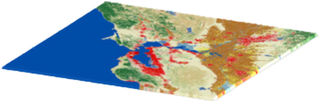
What is Raster Data?
Raster data is made up of tiny squares called pixels or grid cells. These pixels are usually arranged in a regular pattern and are square in shape, but they don’t have to be. Each pixel has a value or a class associated with it.
Think of it like a grid of tiny boxes!
Each box (or pixel) can have a value, like a number, or a class, like a category. This helps us understand and work with geographic data in a more visual way.
| File Type and Extension | Description |
|---|---|
| ERDAS Imagine (.IMG) | A proprietary file format developed by Hexagon Geospatial for storing raster data, like satellite images. |
| American Standard Code for Information Interchange ASCII Grid (.ASC) | A text file format that stores GIS data in a delimited format, like a table. |
| GeoTIFF (.TIF, .TIFF, .OVR) | An industry standard file format for GIS and satellite remote sensing applications. It can have companion files like .TFW, .XML, .AUX, and .OVR. |
| IDRISI Raster (.RST, .RDC) | A file format that assigns numeric grid cell values to raster layers, with a companion text file (.RDC) that stores metadata. |
| Envi RAW Raster (.BIL, .BIP, .BSQ) | A raster storage extension for aerial and satellite imagery, with different formats for storing pixel information. |
| PCI Geomatics Database File (PCIDSK) (.PIX) | A flexible file format that stores image and auxiliary data in a self-contained file, like a database. |
| Esri Grid | A proprietary format developed by Esri that can store attribute data in a raster file, with two types: integer and floating point grids. |
Compressed Raster File Formats: Making Files Smaller

What is Lossy Compression?
Lossy compression is a way to make files smaller by getting rid of some of the information inside. This might sound bad, but it’s actually okay because the information that’s removed is usually stuff that we don’t really need or notice. This type of compression is called “lossy” because some of the information is lost forever.
Why Use Lossy Compression?
Lossy compression algorithms are really good at making files much smaller, which is helpful when we need to store or share a lot of data. Here are some examples of file formats that use lossy compression to make GIS files smaller:
| File Type and Extension | Description |
|---|---|
| ER Mapper Enhanced Compression Wavelet (.ECW) | A compressed image format for aerial and satellite imagery, known for its high compression ratios and good image quality. Developed by ER Mapper, now owned by Hexagon Geospatial. |
| Joint Photographic Experts Group JPEG2000 (.JP2) | A wavelet compression format with lossy or lossless compression options. Requires a world file for geolocation. Ideal for background imagery due to its compression ratio of up to 20:1. |
| LizardTech Multiresolution Seamless Image Database MrSID (.SID, .SDW) | A proprietary format for orthoimages, with impressive compression ratios (up to 20:1 for color images). Accompanied by a world file with .SDW extension. Can be read and written using LizardTech’s GeoExpress software. |
Geographic Database File Formats: Storing Location Information

What is a Database?
A database is a collection of information that is organized and stored in a way that makes it easy to find and use. Think of it like a digital filing cabinet!
What is a Geographic Database?
A geographic database is a special type of database that stores information about locations and places. This means we can store data like maps, coordinates, and other location-based information.
Why is this Important?
Geographic databases are important because they allow us to store and analyze location-based data in a way that’s efficient and easy to use. This is helpful for things like mapping, navigation, and understanding geographic patterns and trends.
| File Type and Extension | Description |
|---|---|
| Esri File Geodatabase (.GDB) | A container for storing multiple types of geographic data, like maps, coordinates, and attribute tables. It’s fast, versatile, and can handle large amounts of data. |
| Esri Personal Geodatabase (.MDB) | An older type of geodatabase that was limited in storage capacity (only 2GB). It’s been replaced by file geodatabases, which offer more storage and features. |
| OGC GeoPackage (.GPKG) | A self-contained database that can store various types of geographic data, like vectors, rasters, and attributes. It’s easy to share and use. |
| Mapbox MBTiles (.MBTILES) | A file format for storing and packaging map tiles, like those used in online maps. It’s designed for web and mobile applications. |
| GE Smallworld Version Managed Data Store (.VMDS) | A database storage format used in the Smallworld software, which is popular in industries like electrical and telecommunication. |
| SpatiaLite (.SL3, .SQLITE) | A database format that adds spatial capabilities to the SQLite engine. It’s open source, lightweight, and can store spatial and non-spatial data in a single file. |
Relational Database Management System (RDBMS) Enterprise: A Powerful Tool for Teams

What is an RDBMS?
A Relational Database Management System (RDBMS) is a type of database that helps teams work together on projects. It’s like a digital filing cabinet that multiple people can access and edit at the same time!
What can an RDBMS do?
An RDBMS is great for teams because it allows:
- Multiple users to edit the database at the same time
- Version control, so you can keep track of changes
- Automatic backups, so you don’t lose important data
- Recovery options, in case something goes wrong
This makes it a powerful tool for teams working on big projects, especially in a business or enterprise setting.
| File Type and Extension | Description |
|---|---|
| PostGIS + PostgreSQL | A powerful combination of open-source tools that adds spatial features to the PostgreSQL database. It allows teams to store, query, and manage location data and maps. |
| ArcSDE Enterprise Geodatabase + (Oracle, Microsoft SQL Server, IBM DB2) | A database system that helps teams work together on location data projects. It supports multiple users, version control, backups, and recovery, and can be used with different database storage models. |
- PostGIS + PostgreSQL: A powerful database combination for storing and managing location data and maps.
- ArcSDE Enterprise Geodatabase: A database system that helps teams work together on location data projects, with support for multiple users and version control.
LiDAR File Formats: Mapping the Earth in 3D
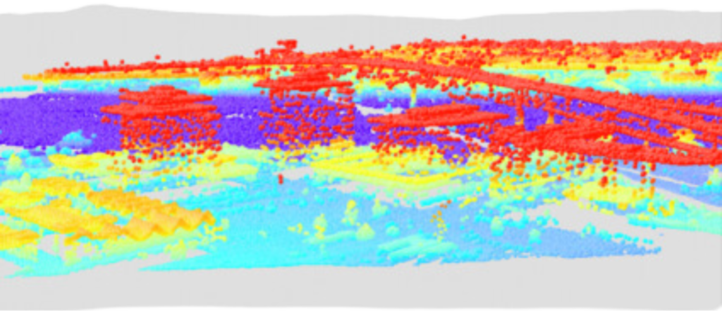
What is LiDAR?
LiDAR (Light Detection and Ranging) is a technology that uses lasers to create detailed 3D maps of the Earth’s surface. It’s like a super-accurate scanner that helps us understand the shape and features of our planet!
What is LiDAR data?
LiDAR data is made up of millions of tiny points, each with its own coordinates (x, y, z) and elevation value. This creates a dense network of points that can be used to create detailed 3D models of the Earth’s surface.
Specialized software needed
Because LiDAR data is so detailed and complex, it requires special software or extensions to view or edit. This software helps us make sense of the data and create useful maps and models.
| File Type and Extension | Description |
|---|---|
| ASPRS LiDAR Data Exchange Format (.LAS, .LASD, .LAZ) | A special file format for sharing LiDAR data between companies and customers. It keeps all the important information about the LiDAR data without losing any details. |
| Point Cloud XYZ (.XYZ) | A simple file format that stores LiDAR data as plain text. It usually includes the X, Y, and Z coordinates, but can also include other information like color and intensity values. |
- ASPRS LiDAR Data Exchange Format (.LAS, .LASD, .LAZ):
- .LAS files are used to share LiDAR data between companies and customers.
- .LAZ files are compressed versions of .LAS files, which save storage space without losing any information.
- .LASD files reference a set of .LAS files and allow you to examine and visualize the 3D point cloud data.
- Point Cloud XYZ (.XYZ):
- A simple file format that stores LiDAR data as plain text.
- Can be opened and edited in a text editor.
- Usually includes X, Y, and Z coordinates, but can also include other information like color and intensity values.
CAD File Formats: Designing and Mapping
What is CAD?
CAD (Computer-Assisted Drafting) is a technology used to create digital designs and models. It’s like drawing with a computer!
How does CAD relate to GIS?
CAD and GIS (Geographic Information System) often work together. GIS uses maps and location data, and CAD designs can be imported into GIS systems. This means that designs created with popular CAD software like Autodesk or Bentley Systems MicroStation can be used in GIS to help plan and understand spatial data.
| File Type and Extension | Description |
|---|---|
| Autodesk Drawing (.DWF, .DWG, .DXF) | File formats used for 2D and 3D designs, containing elements like lines, curves, and text. They use coordinates to plot points on a grid. |
| Bentley Microsystems DGN File Format (.DGN) | The native format for Bentley Systems MicroStation, used for construction design. It includes layers, style information, and spatial references. |
- Autodesk Drawing (.DWF, .DWG, .DXF):
- .DWF is for viewing and sharing designs online.
- .DWG is the main format for AutoCAD, containing metadata.
- .DXF is for exchanging data between CAD programs.
- Bentley Microsystems DGN File Format (.DGN):
- Used for construction design and engineering.
- Includes layers, points, lines, and polygons.
- Contains style information and spatial references.
Elevation File Formats: Understanding 3D Maps
What are elevation file formats?
Elevation file formats are special types of files that help us understand the height and depth of the Earth’s surface. They’re like 3D maps that show us the ups and downs of our planet!
How do they work?
Some examples of elevation file formats are the USGS DEM and Canadian CDED. These formats use a grid, like a raster image, to store elevation values at regular intervals. This helps us see the shape and features of the Earth’s surface in a detailed way.
| File Type and Extension | Description |
|---|---|
| USGS DEM, Canadian CDED (.DEM) | A file format developed by the USGS to store 3D map information. It’s a single file with three parts: Record A (basic info), Record B (header and elevation profile), and Record C (optional accuracy data). |
| Digital Terrain Elevation Data (DTED) (.DT0, .DT1, .DT2) | A standard format created by the National Geospatial-Intelligence Agency. It stores terrain elevation values, often from aircraft radar, with three levels of resolution: Level 0 (1 km), Level 1 (100 m), and Level 2 (30 m). |
Web File Formats: Sharing Maps Online
There are special file formats that help us share and view geographic features on the internet. These formats are designed specifically for web mapping, which means they’re perfect for displaying maps and geographic data online.
While there are other file formats that store geographic data, like GeoJSON, the ones we’re talking about are extra special because they’re made just for web mapping. They help us share and view maps online in a way that’s easy and fun!
| File Type and Extension | Description |
|---|---|
| GeoRSS (.XML) | A special type of file that adds geographic data to RSS feeds, which are like news updates for websites. This helps us share maps and locations with others. |
| Web Feature Service (WFS) (URL) | A way to share maps and data over the internet, so others can use them in their own maps and apps. It’s like sharing a map with a friend, but online! |
| Esri ArcGIS Online Web Services (URL) | A platform that lets users share their maps and data with others online. It’s like a cloud-based map library! |
GIS Project Files: Organizing Maps and Data
You know how you organize your school projects into folders and files? Well, GIS (Geographic Information System) software uses special files called project files to organize maps and data too!
These project files are like a container that stores all the different layers of a map, like roads, buildings, and boundaries. They also keep track of how the layers are displayed, including things like:
- Symbology (like colors and symbols used to represent different features)
- Queries (like searches for specific data)
- Labeling (like names and labels for different features)
- Other properties (like colors and fonts)
By storing all this information in one place, GIS project files make it easy to build and share maps, and to collaborate with others on mapping projects!
| File Type and Extension | Description |
|---|---|
| Map Exchange Document (.MXD) | A file that stores map layers and their properties, like colors and symbols, in a table of contents. |
| QGIS 2.X Project File (.QGS) | A project file that stores all map layers, composers, and labeling, similar to a .TXT or .XLS file. |
| ArcGIS Pro Project File (.APRX) | A file that contains maps, toolboxes, databases, and connections to databases and servers, and can have multiple maps and layouts. |
| QGIS 3 Project File (.QGZ) | A zipped container that stores the QGS XML file and is used for storing QGIS layouts, properties, and layers. |
| Map Exchange Document Template (.MXT) | A standardized layout for Esri ArcGIS that contains common basemaps and page layouts for repeated use. |
| MapInfo Workspace (.WOR, .MWS) | A file that stores a set of map layers, symbology, and color palettes for printing. |
| Esri ArcGlobe Document (.3DD) | A file that houses all feature and raster layers in a global view for 3D visualization and analysis. |
| Esri ArcScene Document (.SXD) | A file that saves the scene’s view, layers, and properties for 3D feature and raster viewing. |
| IDRISI Map Composition File (.MAP) | A file that stores a set of map layers, symbology, and color palettes for printing. |
Cartographic File Formats: Standardizing Map Creation
Have you ever noticed how maps have a consistent look and feel? That’s because cartographers use special file formats to standardize map creation!
These file formats don’t store the actual map data, but they do contain the instructions for how to display the map features, like symbols, labels, and colors. This helps cartographers create maps that are easy to read and understand.
Think of it like a recipe book for map-making. The file format provides the ingredients (symbols, labels, etc.) and instructions for how to combine them to create a delicious map!
By using these standard file formats, cartographers can ensure that their maps are consistent, clear, and easy to use. It’s like a secret code that helps them create amazing maps!
| File Type and Extension | Description |
|---|---|
| Esri ArcGIS Layer File (.LYR, .LYRX) | A file that tells a map how to display data, like colors and symbols, but doesn’t store the data itself. |
| QGIS Layer Definition File (.QLR) | A file that stores how a layer should look and points to the data, but doesn’t hold the data. |
| Esri ArcGIS Style File (.STYL, .STYLX) | A collection of symbols and icons for different themes, like forestry or geology, to style map features. |
| QGIS Style File (.QML) | A file that contains how features should be styled and labeled in a QGIS project. |
How Well Do You Know Your GIS Formats?
As you work with GIS (Geographic Information System), you’ll come across many different file formats. GIS has evolved in exciting ways, like:
- From 2D to 3D: Three-dimensional file formats add depth and make maps more realistic.
- From fixed to dynamic time: Multi-temporal formats let you see how things change over time.
GIS is an amazing and constantly growing technology, with many different file formats to learn about. It’s like a toolbox with many different tools, each with its own special job!
Understanding these formats will help you work more efficiently and effectively in GIS. So, let’s explore and learn about the various GIS formats out there!