Skip to content
Remote Sensing & GIS Club

Remote Sensing & GIS Club

  • Software
  • GIS Blogs
  • Quiz
  • Maps
  • Portfolio
  • Online GIS Tools

satellite remote sensing

GeoAI: Artificial Intelligence in Geography

January 22, 2024January 20, 2024

Picture your GIS software not only being knowledgeable but also continually learning, becoming more intelligent and adept at understanding the world around us. Welcome to …

Read more

What is the difference between LSWI, MSI

November 28, 2023

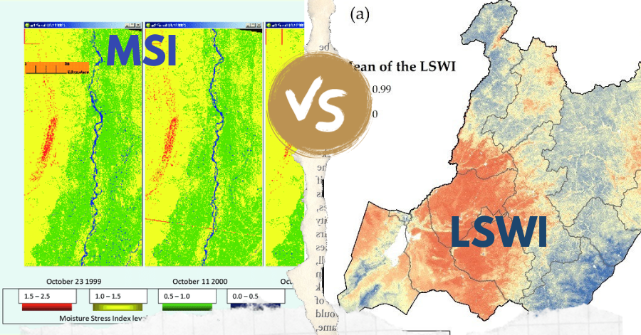
In the realm of remote sensing, the Leaf-Water Stress Index (LSWI) and the Moisture Stress Index (MSI) stand out as key tools for assessing vegetation …

Read more

The 50 Most Influential Satellites in Remote Sensing

October 30, 2023October 30, 2023

Unlock the Secrets of the Cosmos with “The Grand Satellite Catalog” Embark on a celestial odyssey, exploring the technological marvels that have pioneered the realm …

Read more

  • Featured
  • Fiverr
  • GIS Blogs
  • Jobs
  • Maps
  • Reviews
  • Software
  • Tools
  • Uncategorized

Tags

advance GIS application if gis in agriculture arcgis arc gis Arcgis online arcgisonline arcgis pro arcmap cartography data analysis Data Visualization esri esri company geographic information geographic information system geo information system Geospatial geospatial analysis Geospatial Data Geospatial Technology gis gis analysis gis jobs GIS Mapping GIS professionals gis software google earth lidar map mapping perfect gis python qgis remote sensing remote sensing data reviews satellite imagery soledad sony alpha spatial Spatial Analysis Spatial Data tech urban planning visualization
© RSGIS Club. All Rights Reserved.