Skip to content
Remote Sensing & GIS Club

Remote Sensing & GIS Club

  • Software
  • GIS Blogs
  • Quiz
  • Maps
  • Portfolio
  • Online GIS Tools

water resource management

pakistan flood map

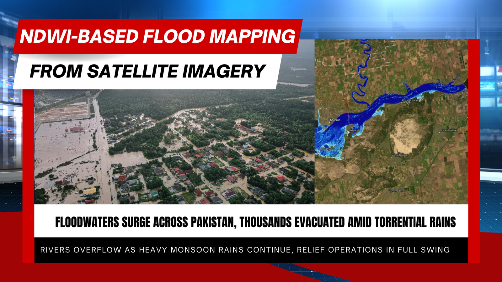
How the Normalized Difference Water Index (NDWI) Is Used to Map Flooding

September 1, 2025

The Normalized Difference Water Index (NDWI) is a widely used remote-sensing index that helps detect and measure water—both as surface water and as moisture in …

Read more

  • Featured
  • Fiverr
  • GIS Blogs
  • Jobs
  • Maps
  • Reviews
  • Software
  • Tools
  • Uncategorized

Tags

advance GIS application if gis in agriculture arcgis arc gis Arcgis online arcgisonline arcgis pro arcmap cartography data analysis Data Visualization esri esri company geographic information geographic information system geo information system Geospatial geospatial analysis Geospatial Data Geospatial Technology gis gis analysis gis jobs GIS Mapping GIS professionals gis software google earth lidar map mapping perfect gis python qgis remote sensing remote sensing data reviews satellite imagery soledad sony alpha spatial Spatial Analysis Spatial Data tech urban planning visualization
© RSGIS Club. All Rights Reserved.