
Unlock the Secrets of the Cosmos with “The Grand Satellite Catalog” Embark on a celestial odyssey, exploring the technological marvels that have pioneered the realm of remote sensing. From the enigmatic depths of meteorology to pinpoint precision in navigation, we present a constellation of the 50 most legendary satellites gracefully orbiting our planet. So, let’s commence this cosmic journey!
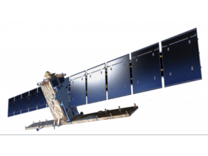
Landsat
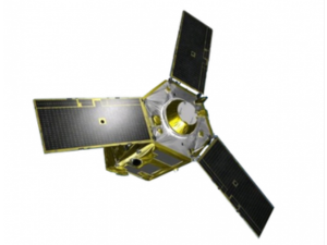
Sentinel

For over four decades, Landsat has inscribed the annals of Earth’s history in its enduring legacy. A versatile virtuoso, it even captured the elusive Landsat Island in the vast expanse of Canada.
A revolutionary vanguard within the Copernicus Programme, Sentinel’s fleet of six missions redefines the art of remote sensing. Among its ranks, Sentinel-2 shines as the heir to Landsat’s throne, though it leaves behind the thermal band.
Terra

As a crucial member of NASA’s multi-talented A-Train fleet, Terra is the Swiss Army Knife of satellites. For instance, it features ASTER, the terrain sculptor, MODIS, the land cover classifier, and MOPITT, the air quality sentinel.
EnviSAT

In its heyday, EnviSAT was a titan, studying the oceans, terrain, and atmosphere with unwavering dedication. But today, it lies dormant, its colossal frame making it a prime candidate for orbital retirement.
Worldview

Maxar’s cutting-edge high-resolution satellite, Worldview, boasts breathtaking clarity with a resolution of 31 centimeters. It’s the sole commercial satellite capable of delivering such precision, revealing even the minutiae like license plates.
PlanetScope (Dove)

Planetscope, an assembly of low-cost microsatellites nicknamed doves, gracefully scans Earth’s surface from low orbit. Their harmonious performance captures images at a remarkable resolution of 3-5 meters.
Global Navigation Satellite System (GNSS)

Every time you enable location services on your smartphone, you tap into the intricate web of GNSS. Daily, the 35-satellite system guides our GPS receivers to pinpoint our precise location on Earth.
Shuttle Radar Topography Mission (SRTM)

In just 11 days aboard the space shuttle Endeavour, SRTM crafted a meticulous 30-meter terrain model of our planet using radar antennas and interferometry.
Corona

Once a clandestine James Bond-style military satellite, Corona now serves archaeologists and curiosity seekers with declassified images of the past.
Earth Observing-1 Mission (EO-1)

EO-1’s mission was to push the boundaries of science and technology. With Hyperion’s 220 spectral bands, it offered unprecedented insights into Earth’s diverse landscapes.
Satellite Pour l’Observation de la Terre (SPOT)

Since 1986, France’s SPOT-1 satellite has been an essential observer, documenting Earth’s vegetation, elevation, and even the Chernobyl disaster.
RADARSAT

Radarsat-2 stands sentinel as Canada’s space radar monitoring mission, part of the Radarsat Constellation Mission. Three C-band satellites focus on the Great White North’s vast territory.
IKONOS

IKONOS was the first commercial satellite to receive a license in the United States, although IKONOS-1 never made it to space. IKONOS-2 carried the torch, earning its place among the stars.
Quickbird

QuickBird was the versatile workhorse of its time, offering optical imagery at an astonishing 60cm resolution until its retirement in 2015.
RapidEye

RapidEye, born in Germany, found its way through various owners to its current home at Planet. This constellation of five satellites offers 5-meter resolution imagery daily.
Pleiades
Pleiades, a pair of nimble satellites, provides exquisite 2-meter resolution imagery, capturing the Earth’s beauty from every angle.
China-Brazil Earth Resource Satellite (CBERS)

China and Brazil join forces in a quintuple mission, monitoring agriculture, environment, water pollution, and urban planning in both nations.
Project for On-Board Autonomy (PROBA)

PROBA, a microsatellite with a cube-like appearance, carries hyperspectral data with a 30-meter resolution. Its dynamic viewing angles have created a global vegetation archive.
ResourceSAT

Originally known as IRS, ResourceSAT, an Indian polar-synchronous satellite, comes equipped with an Automatic Identification System (AIS) payload for ship surveillance.
KOMPSAT (Arirang)

KOMPSAT, also known as Arirang, captures the world with 1-meter resolution imagery, rumored to monitor North Korean activities while serving commercial purposes.
CartoSAT

India’s commercial satellite series, CartoSAT, employs multispectral, panchromatic, and stereo mapping to collect vital land information.
GeoEye

GeoEye’s high-resolution imaging satellite, with 1.65-meter precision, helps ecologists monitor wildlife populations, and its imagery is integral to Google Maps.
Disaster Monitoring Constellation (DMC)

The DMC, a humanitarian constellation featuring AISAT-1, BilSAT, NigeriaSAT, UK-DMC, Beijing-1, and Deimos-1, excels in disaster monitoring and rapid response.
SkySat

SkySat, capturing video at sub-meter resolution, is the vanguard of orbital espionage, akin to a gadget from a James Bond movie.
Tropical Rainfall Measuring Mission (TRMM)

TRMM explores cloud structures and precipitation, illuminating global energy balances, water cycles, and El Niño’s mysteries.
Geostationary Operational Environmental Satellite (GOES)

Since 1975, the unsung heroes of the geostationary GOES squad have been forecasting Earth’s ever-changing weather patterns.
National Oceanic and Atmospheric Administration Satellite (NOAA)

NOAA satellites provide a comprehensive view of global weather and environmental conditions every day.
METEOSAT

Meteosat, stationed in geostationary orbit over Europe and Africa, broadcasts images of Europe’s ever-shifting weather every 15 minutes, making it indispensable for weather forecasting.
Aqua

Aqua, NASA’s multi-purpose satellite, delves into Earth’s water cycle, measuring humidity, cloud height, and energy flux, offering invaluable insights.
Cloud-Aerosol Lidar and Infrared Pathfinder Satellite Observations (CALIPSO)

CALIPSO employs laser technology and specialized sensors to create intricate profiles of cloud structures, enhancing our understanding of atmospheric phenomena.
Television Infrared Observation Satellites (TIROS)

In the 1960s, TIROS pioneered early storm warnings. This low-Earth orbiting satellite was designed for televising infrared weather observations.
CloudSAT

With its head in the clouds, CloudSAT employs radar to profile vertical cloud formations. It plays a vital role in understanding the influence of clouds on weather and climate.
Aura

Aura, NASA’s sentinel, is dedicated to uncovering air quality and climate health. Its instruments measure trace gases, temperature, and aerosols in the upper atmosphere.
Suomi

Suomi orbits the poles, facilitating weather forecasting and land and ocean studies. Throughout history, it has captured breathtaking views of monstrous tornadoes and supercells.
Polar-orbiting Operational Environmental Satellites (POES)

NOAA’s polar-orbiting meteorological satellite has demystified atmospheric phenomena with high-resolution imagery.
Soil Moisture Active Passive (SMAP)

SMAP employs active and passive sensors to measure global soil moisture, enhancing our understanding of land and ocean processes.
SciSAT

SciSAT ventures into the shadows of Earth, recording ozone depletion exclusively on the dark side of our planet.
ACRIMSAT

ACRIMSAT conducted experimental studies on solar irradiance, even capturing the Venus shadow’s 0.1% reduction in solar intensity in 2004.
Megha-Tropique

Megha-Tropique explores the tropics in its quest to understand the global water cycle, contributing to the study of climate change.
IceSAT

IceSAT, with its space-borne laser altimeter, has made over 904 million measurements of Earth’s surface, covering everything from forest heights to ice thickness.
Gravity Recovery and Climate Experiment (GRACE)

This tag team of satellites chases each other in the same orbit, measuring tiny shifts to decipher variations in Earth’s gravity pull.
Gravity Field and Steady-State Ocean Circulation Explorer (GOCE)

GOCE excels in measuring Earth’s gravity field and ocean behavior with unmatched precision, aided by sensitive gradiometers and accelerometers.
Magnetospheric Multiscale Mission (MMS)

MMS delves into the magnetosphere, with a formation of four identical spacecraft mapping the intricate interaction between the sun and Earth’s magnetic field.
Advanced Land Observation Satellite (ALOS)

ALOS-1 pioneered precise elevation modeling at a 5-meter resolution, while ALOS-2 continues the legacy with enhanced features like L-band PALSAR radar and stereo mapping.
TerraSAR (TanDEM-X)

TerraSAR and TanDEM-X, the twin German satellites, unite to craft the unparalleled WorldDEM using X-band radar, vital for disaster management, environmental monitoring, and geological studies.
Mars Orbiter Laser Altimeter (MOLA)

MOLA reigns supreme on Mars, mapping the planet’s topography and revealing ancient riverbeds etched into its surface.
Joint Altimetry Satellite Oceanography Network (JASON)

JASON’s altimeter is the key to mapping the ocean floor’s bathymetry. This upgraded version of TOPEX/Poseidon monitors rising sea levels, a critical indicator of climate change.
SeaStar (Orbview-2)

Biologists rely on SeaStar to measure color changes caused by chlorophyll in marine plants, playing a pivotal role in understanding ocean biology.
QuickSCAT

QuickSCAT, the choice of surfers, measures sea winds and direction, but only for ice-free oceans, where its scatterometer is most effective.
Soil Moisture and Ocean Salinity (SMOS)

SMOS contributes to our understanding of soil moisture and ocean salinity through its passive instrumentation, enriching our knowledge of both land and ocean processes.
In conclusion, the realm of remote sensing offers an extensive array of applications deeply interwoven with our everyday existence. Take, for instance, our enhanced comprehension of diverse domains, such as meteorology, navigation, gravitational forces, climate dynamics, and the enigmatic magnetosphere, all made possible through space-based observation.
With each meticulously orchestrated space mission, we expand our scope of exploration, leaving no Earth observation satellite unaccounted for.
Have we overlooked a vital Earth observation satellite? Your insights and contributions are highly valued; please feel free to share your thoughts in the comments section below.