In the field of Geographic Information Systems (GIS), a crucial aspect that governs the accurate representation and analysis of spatial data is the concept of datum. Datum serves as a reference framework for establishing the positions of geographic features on the Earth’s surface. It is a fundamental component of GIS and plays a vital role in ensuring the compatibility and interoperability of spatial data across different systems and applications. This article aims to demystify the concept of datum and shed light on its significance in the realm of GIS.
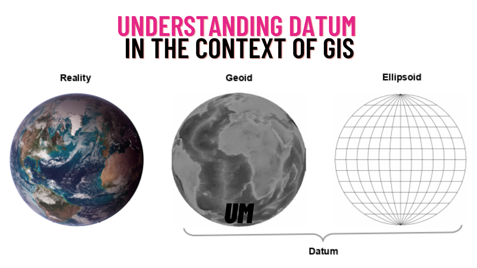
Defining Datum: In simple terms, a datum is a mathematical model that describes the shape, size, and orientation of the Earth’s surface. It provides a framework for precisely defining the positions of points, lines, and polygons on a map or in a GIS dataset. A datum typically consists of a reference ellipsoid (a mathematical approximation of the Earth’s shape) and a set of parameters that define its position and orientation relative to the Earth’s center and rotational axis.
Types of Datums: There are several datums in use today, each developed to cater to specific regional or global requirements. Some commonly encountered datums include the North American Datum of 1983 (NAD83), the World Geodetic System of 1984 (WGS84), the European Terrestrial Reference System 1989 (ETRS89), and the International Terrestrial Reference Frame (ITRF). These datums vary in terms of their geometric models, reference points, and coordinate systems.
Coordinate Systems and Datum Transformation: Coordinate systems, such as latitude and longitude or projected coordinate systems, are closely tied to a specific datum. Consequently, spatial data collected or created using different datums may not align accurately when combined or overlaid. To address this issue, datum transformation is employed to convert data between different reference frames. Datum transformation involves a series of mathematical calculations to shift coordinates from one datum to another, ensuring spatial consistency and accuracy.
The Impact of Datum on GIS Data: The choice of datum has a direct impact on the precision and reliability of GIS data. If spatial data collected or referenced using an incorrect datum is used without appropriate transformation, it can introduce distortions and errors into the analysis, leading to inaccurate results. This is especially crucial when working with large-scale projects, where even slight misalignments can have significant consequences.
The Emergence of Global Navigation Satellite Systems (GNSS): With the advent of Global Navigation Satellite Systems (GNSS), such as GPS (Global Positioning System), GLONASS (Global Navigation Satellite System), and Galileo, the accessibility and accuracy of positioning information have significantly improved. These systems rely on satellite measurements to determine precise positions on the Earth’s surface, and they typically employ the WGS84 datum as their reference framework.
In the world of GIS, understanding and managing datums is of utmost importance to ensure the accuracy and integrity of spatial data. By establishing a consistent reference framework, datums enable the seamless integration and analysis of diverse datasets. Moreover, as technology advances and global positioning systems evolve, staying aware of the underlying datum becomes even more critical to leverage the full potential of GIS in various applications, ranging from urban planning and environmental management to transportation and emergency response.