Introduction
3D mapping, an innovative technology making waves in the geospatial industry, involves capturing elevated locations in a digital format. In simpler terms, it creates a detailed digital representation of the real world, allowing users to explore geographical information with unprecedented detail. This article aims to provide an introduction to 3D mapping, explaining its essence, functionality, and significance for those involved in the geospatial industry.
A Digital World Unveiled
Before delving into the intricacies of 3D mapping, it’s crucial to grasp its essence. Unlike traditional two-dimensional paper maps, 3D mapping captures and stores three-dimensional information, offering a comprehensive view of Earth’s topography. Imagine walking around a building as someone captures it from various angles; in 3D mapping, this allows us to identify and understand the structure more accurately.
How 3D Mapping Operates
To comprehend how 3D mapping functions, envision using Google Earth to tilt and explore the 3D terrain. The data appears complex, but it essentially comprises two types of 3D data – 3D models and terrain information. 3D models, representing physical objects, can include bridges, buildings, and monuments, either automatically generated or crafted using design software. Terrain information, achieved through tools like photogrammetry, overlays orthoimagery onto a 3D terrain, forming detailed representations of landscapes.
Advantages of 3D Mapping
The benefits of 3D mapping are abundant. This technology facilitates novel visualizations of physical surroundings, aiding in problem identification and space optimization. Detailed views of buildings and roads offer enhanced accuracy, helping in site selection and decision-making. Architects benefit from creating realistic renderings, while engineers make informed decisions by understanding spatial interactions, optimizing resource use, and improving safety. Moreover, 3D mapping extends beyond practical applications to creative uses, such as designing buildings, crafting augmented reality content, and performing 3D analysis.

Exploring 3D Mapping Software
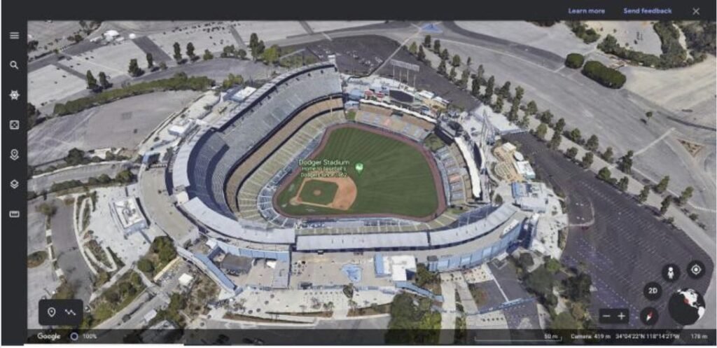
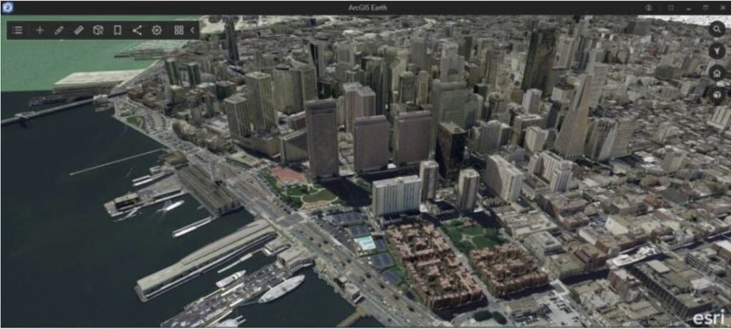
Various 3D mapping software options are available, each catering to specific needs. Google Earth, an online tool, allows users to generate 3D views and explore major landmarks. ArcGIS Pro, with native 3D capabilities, excels in creating, analyzing, and visualizing 3D data. Autodesk Revit, a 3D architectural design and BIM software, is ideal for architects, engineers, and construction professionals.
In conclusion, 3D mapping stands as a captivating technology poised to revolutionize our interaction with geography. Its transformative potential becomes evident as geospatial technology evolves. With 3D mapping, we gain a profound understanding of the world’s terrain and geographical information, opening doors to both practical and creative applications.