Terrestrial Laser Scanning (TLS) is a ground-based LiDAR technology used to capture highly detailed 3D information. Unlike airborne LiDAR systems that collect data from above, TLS operates from the ground and produces point clouds from a horizontal or near-horizontal angle. This makes it especially useful for mapping buildings, infrastructure, vegetation, and other vertical or complex structures.
How Does Terrestrial Laser Scanning Work?
TLS works by emitting rapid laser pulses toward surrounding surfaces. Each pulse hits an object and returns to the scanner. By measuring the time it takes for the pulse to return, the system calculates the exact distance to that point.
The scanner repeats this process thousands of times per second, sweeping across all visible surfaces. The result is a dense “point cloud” representing millions of precise 3D coordinates. Terrestrial LiDAR is highly accurate—often achieving precision better than 10 centimeters.
Specialized software processes these point clouds and converts them into detailed 3D models. If the scanner captures RGB imagery during the scan, these colors can be applied to the model, giving it realistic textures and visual detail.
Note
The main difference between airborne and terrestrial LiDAR lies in their perspective. Airborne LiDAR maps terrain from above, while terrestrial laser scanning collects data from the ground.
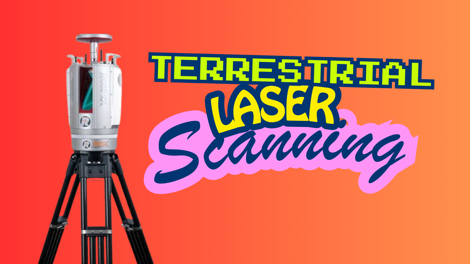
Terrestrial Laser Scanning Equipment
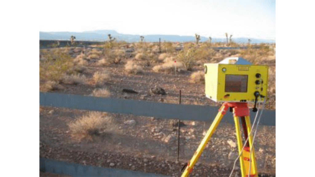
Terrestrial laser scanning relies on a combination of advanced hardware components working together to capture accurate 3D data. At the center of the system is the laser scanner itself, which emits thousands of laser pulses to collect millions of measurement points from the surrounding environment.
For outdoor surveys, GPS is used to record precise geolocation information, while an Inertial Measurement Unit (IMU) monitors the scanner’s orientation and movement. These sensors ensure that every point is correctly positioned and aligned, resulting in highly reliable datasets.
The scanner is typically mounted on a sturdy tripod or specialized mount. This stable platform minimizes vibration, maintains accuracy, and allows the scanner to cover a wide range of angles without physically relocating the device too often.
Additional supporting equipment is also essential. A power source keeps the scanner functioning during fieldwork, on-board or external storage devices save the captured point clouds, and dedicated software is used to process, analyze, and visualize the scanned data.
Use Cases and Applications
Because terrestrial laser scanning produces highly detailed and accurate 3D models, it is used across a wide range of industries:
- Construction: TLS is ideal for monitoring buildings, bridges, and active construction sites. The precise 3D data helps verify that structures are being built according to design specifications and assists in quality control.
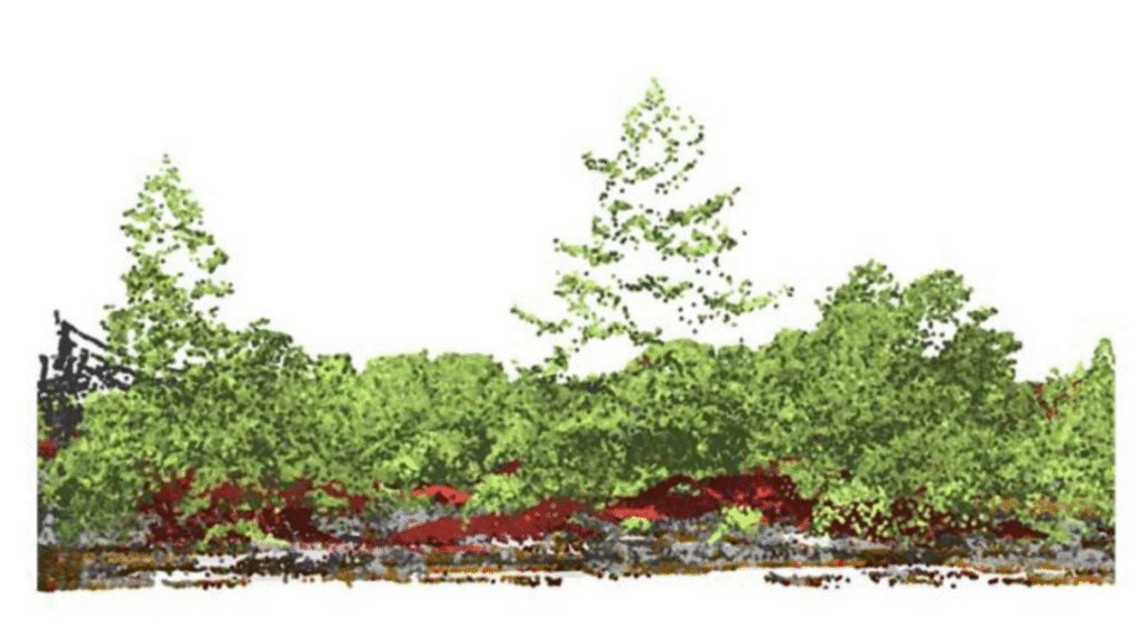
- Forestry: Ground-based laser scanning captures detailed information on tree height, trunk diameter, canopy structure, and forest density. From these measurements, researchers can estimate biomass and assess forest health with high accuracy.
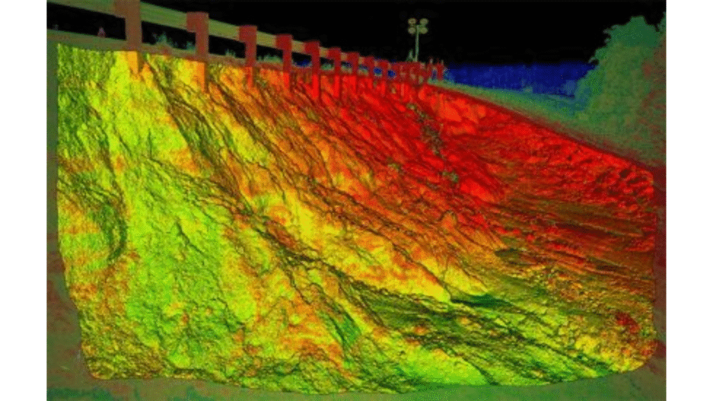
- Mining: TLS is widely used for volume calculations in quarries and open-pit mines. It supports extraction planning, stockpile measurement, and safety assessments by providing dependable spatial data.
- Urban Planning: Planners rely on terrestrial scans to map streetscapes, buildings, and infrastructure. The detailed point clouds support city design, traffic analysis, public-space planning, and infrastructure management.
- Heritage and Archaeology: While airborne LiDAR often gets attention for discovering hidden sites, terrestrial LiDAR is essential for documenting historical structures from the ground. It preserves fine details of monuments, ruins, and cultural heritage sites for restoration and research.
Terrestrial laser scanning continues to expand its role across industries—whether safeguarding ancient sites, improving construction accuracy, or supporting better urban development. Like other LiDAR technologies, it offers a precise view of our environment, enabling smarter and more informed decisions.
Terrestrial LiDAR Scanning
Terrestrial laser scanning has become an essential tool across many disciplines. Its exceptional accuracy and ability to generate detailed 3D models make it a versatile and highly valuable technology for research, analysis, and documentation.
Now we’d like to hear from you—how are you using terrestrial laser scanners? Share your applications and experiences with this powerful ground-based surveying technology.